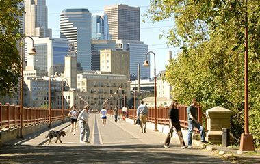
Get out and enjoy the trails and parkways of the Grand Rounds Scenic Byway that showcase parks and lakes, gardens, historical sites, and diverse neighborhoods.
For information about snow plowing on Trails, visit the snow event map. Trail plowing information is updated every three minutes.
Minnehaha Parkway Closure
A section of Minnehaha Parkway is closed through fall 2027 for the City of Minneapolis to rehabilitate the Nicollet Avenue bridge over Minnehaha Creek. Please visit the City of Minneapolis Nicollet Bridge Rehabilitation project page for more information.
Trails under the bridge will stay open, but they may shift temporarily. Please follow onsite signs and any detours in place.
Westbound parkway traffic is detoured on 50th Street to Lyndale Avenue. Eastbound parkway traffic is detoured along the two-block parkway frontage road spanning Nicollet Avenue.
Kenilworth and Cedar Lake Trail Closures
Kenilworth Trail and portions of the Cedar Lake Regional Trail are closed for construction of the Green Line Extension light rail project. Please visit the Metropolitan Council’s Green Line Extension project pagefor details.
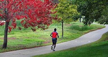
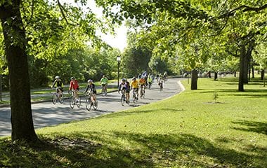
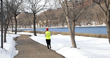
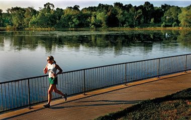
51 miles of paved trails wrap around lakes and along parkways of the Grand Rounds Scenic Byway showcasing parks, gardens, historical sites, beaches, golf courses and diverse neighborhoods.
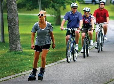
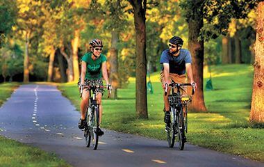
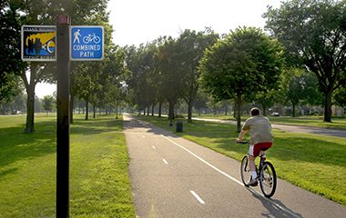
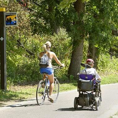
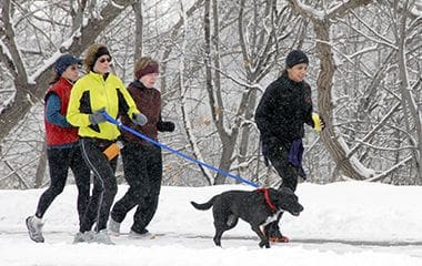
Many trails offer separate paths for walkers/runners and wheeled recreation.
For information about snow plowing on Trails, visit the snow event map. Trail plowing information is updated every three minutes.
Sections of the trail may be closed. See note at top of the page.
The Minneapolis Park and Recreation Board manages the easternmost portion of Cedar Lake Regional Trail, between West River Parkway and the western city boundary.
In Minneapolis, the trail connects to the north end of downtown, including a section under Target Field, Bryn Mawr Meadows Park, Cedar Lake, Kenilworth Regional Trail, Kenwood Parkway and Parade Park (which includes Parade Ice Garden and Parade Stadium).
West of Minneapolis, it travels through St. Louis Park and Hopkins. That section is managed by Three Rivers Park District.
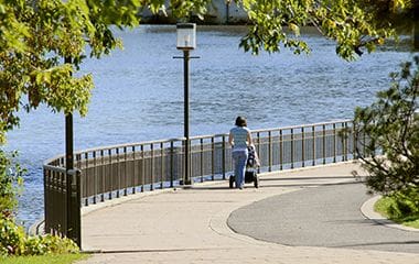
East River Parkway travels along the east bank of the Mississippi River in Minneapolis between the University of Minnesota East Bank campus and the eastern city boundary.
There are parallel trail routes for much of the trail. One is next to the parkway higher up on the river bluff, and one is below, closer to the river. The lower trail passes through East River Flats Park. Beware of flooding on the lower trail.
East of Minneapolis, the trail continues along the river to downtown St. Paul. That section of trail is managed by St. Paul Parks and Recreation.
Kenilworth Regional Trail is closed due to Southwest Light Rail Transit construction. Please visit the Met Council SWLRT page for details.
Kenilworth Regional Trail is an offshoot of Cedar Lake Regional Trail that travels through a wooded corridor separating Cedar Lake and Lake of the Isles.
Kings Highway is a section of Dupont Avenue South between West 36th and 46th Street. Kings Highway looks different than the rest of Dupont Avenue, with southbound and northbound traffic lanes separated by a wide median planted with grass, trees, flowers and bushes.
It connects to Lyndale Farmstead Park and Lyndale Park on the east side of Lake Harriet. It also borders the east side of Lakewood Cemetery.
Known informally as Linden Hills Boulevard, this parkway is just 2-½ blocks long and lacks both the bike lanes and medians typical of other Minneapolis parkways. Its north end in William Berry Park connects with William Berry Parkway and Queen Avenue South; at its south end, it reconnects to Queen Avenue South just past West 43rd Street, at West Lake Harriet Parkway.
Note: Linden Hills Boulevard is proposed for eventual divestment from the park system for several reasons: the lack of space for bike lanes or other amenities; its duplication with Lake Harriet Parkway in connecting William Berry Park and Lake Harriet; and its location outside the boundary of the Minneapolis Chain of Lakes Regional Park. More information is available in the MPRB Southwest Service Area Master Plan.
The Luce Line Regional and State Trails travel about 70 miles altogether, connecting the Minneapolis park system with suburbs and rural communities west of Minneapolis.
The Minneapolis Park and Recreation Board manages the easternmost section of Luce Line Regional Trail. From Theodore Wirth Regional Park it runs through Bassett’s Creek Park and Bryn Mawr Meadows Park (with short on-street connections) and then connects to Cedar Lake Regional Trail (above). Click “View on Google Maps” below for portions of the MPRB section of the trail.
Three Rivers Park District manages eight miles of the Luce Line Regional Trail between Theodore Wirth Regional Park and Plymouth.
The Midtown Greenway Regional Trail travels 5.9 miles from the Mississippi River to the western boundary of Minneapolis where it connects to the Cedar Lake Regional Trail, managed by Three Rivers Park District, leading to St. Louis Park and Hopkins.
Nokomis-Minnesota River Regional Trail connects many south metro trails and attractions.
Built by Three Rivers Park District, the Minneapolis portion of the trail starts at the south shore of Lake Nokomis and travels south along Old Cedar Avenue and Solomon Park before leaving city limits along Bloomington Avenue and connecting to Taft Park in Richfield.
The Minneapolis Park and Recreation Board manages the southern portion of Shingle Creek Regional Trail, between North Mississippi Regional Park and the northern city boundary.
North of Minneapolis, the trail follows Shingle Creek through Brooklyn Center and Brooklyn Park. Three Rivers Park District manages that portion of the trail.
Victory Memorial Drive is centered around a Flagpole Plaza near the intersection with 45th Avenue North. The drive travels north-south between Theodore Wirth Parkway and the Flagpole Plaza, and east-west between the Flagpole Plaza and Webber Parkway.
In its wide, grassy median, 568 evenly spaced trees are planted, each representing a Hennepin County resident who died in World War I. Beside each tree is a bronze memorial marker.
Victory Memorial Drive also connects to Victory Park.
The Wirth Off-Road Cycling Trail offers bikers more than five miles of twists, turns, hills and woods to enjoy year-round.
In the winter, snowshoers can also explore the snow-covered wooded trails of the Off-Road Cycling Area of Theodore Wirth Park, and the Wirth Trail and the Front 9 portion of the Wirth Golf Course.
With 20 miles of groomed cross-country ski trails, the Minneapolis Park System has a trail for skiers of all ages and abilities.
For information about snow plowing on Trails, visit the snow event map. Trail plowing information is updated every three minutes.
Beginning in 2000, the City of Minneapolis has allocated $700,000 each year for parkway repairs and maintenance through its parkway paving program. All reports of potholes, streetlights, traffic signals or traffic signs on parkways should be reported to the City of Minneapolis through 311.
MPRB parkways are included in City of Minneapolis snow emergencies. Sign up to receive alerts when a snow emergency is declared.
Parkway Use: You must obtain a permit for special use of the parkway including closures, and dumpsters, trucks, limousines or carriages on the parkway. View parkway permit details. Parkway Use Permit Application [PDF].
Trail Safety
Trail Etiquette and Safety
Pedestrians may not walk or run on a bike path
Bicyclists, skateboarders, roller skaters, in-line skaters, and roller skiers may not use pedestrian paths
When using a park pathway, stay to the right unless passing
Bikers may not ride faster than 10 miles per hour
Bike paths at Lake Harriet, Bde Maka Ska and Lake of the Isles are one-way
Dispose of trash and recyclables in the proper containers
Do not pick flowers or deface trees or shrubs
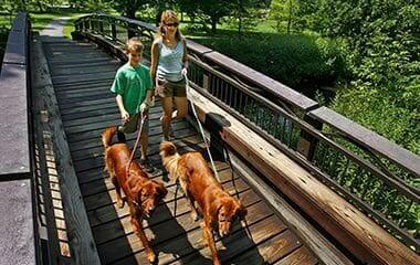
Pick up after your dog and keep them on a leash unless in an off-leash dog park
During the winter months we plow and sand the bike paths for pedestrians and bikers to share. Bikers must yield to pedestrians.