


East River Flats Park
Address
351 East River Parkway
Minneapolis, MN 55455
Plan Your Route
Contact
Phone: 612-230-6400
Email: info@minneapolisparks.org
Park Hours
6 am-midnight in developed areas
6 am-10 pm in undeveloped areas
Ordinance PB-2-33
East River Flats Park
Part of: Mississippi Gorge Regional Park
Find a Recreation Center
Park Projects
This park will be affected by a park improvement project. View Mississippi Gorge Trail and Riverfront Improvements.
Features & Amenities
- Pay Parking Lot
- Picnic Area
- Restroom Facility
- Walking Path
Not finding what you’re looking for?
Search Parks & Destinations
Good to Know
A pay parking lot is available.

Park Details
Site of the boathouse for the U of M’s women’s rowing team.
Rentals & Permits
Annual Patron Parking Permit: Enjoy parking privileges in specially designated spaces at some of our most popular regional parks. View parking permit details.
Outdoor Use and Event Space: Learn how to reserve park space for corporate events, community celebrations, and more.
Parkway Use: You must obtain a permit for special use of the parkway including closures, and dumpsters, trucks, limousines or carriages on the parkway. View parkway permit details.
Outdoor Weddings: Make your outdoor ceremony unique and memorable. View wedding permit details.
Food Truck Permit: City of Minneapolis licensed food truck operators can apply for a one-day permit at this park. View food truck permit details.
History
Name: In December 1894, upon the suggestion of William Folwell, the board approved naming the east river flats “Cheever’s Landing,” for the man who had operated a ferry on the site in the early days of the city. While the name was officially adopted, the area has always been referred to informally as the East River Flats Park.
Acquisition and Development:
Shortly after the city’s voters gave their approval for a park board in April 1883, the new board hired Cleveland to create a general plan for the development of Minneapolis parks. In his “Suggestions for a System of Parks and Parkways for the City of Minneapolis,” presented to the park board June 2, 1883, Cleveland devoted considerable attention and passion to creating a park on the river banks on both sides of the river. He wrote:
“The Mississippi River is not only the grand natural feature which gives character to your city and constitutes the main spring of prosperity, but it is the object of vital interest and center of attraction to intelligent visitors from every quarter of the globe, who associate such ideas of grandeur with its name as no human creation can excite. It is due therefore, to the sentiments of the civilized world, and equally in recognition of your own sense of the blessings it confers upon you, that it should be placed in a setting worthy of so priceless a jewel.”
He went on to write that a boulevard along the banks of the river would be of “such picturesque character as no art could create and no other city can possess.” As for how to develop the river banks into a park, Cleveland wrote, “No artist who has any appreciation of natural beauty would presume to do more than touch with reverent hands the features whose charms suggest their own development. No plan for such work could be made.”
What he did propose was a park on the east river flats, opposite Riverside Park on the west bank, which the park board had already designated for acquisition and a bridge over the river linking the two parks.
Despite the best efforts of the park board, Cleveland’s vision for the east river bank would not be realized for nearly a decade.
When the east river bank was acquired the river was not as we know it today. It was wilder, rockier, narrower, and dotted with islands; it was not navigable by steam boats. That began to change, and the park board’s river acquisition began to shrink, when in 1895 the park board granted flowage rights and deeds for portions of the east river park to the U.S. Government for the construction of the Meeker Island lock and dam. When construction of the dam began in 1898 the park board granted the U.S. Army Corps of Engineers permission to use part of the parkway for trackage and storage during construction.
Despite the imminent loss of land at the east river flats to the reservoir created by the dam, the park board commissioned landscape architect Warren Manning to develop a plan for the layout of the east river park in 1899. Manning noted in his report on the park system in 1899 that he had submitted plans, which were being executed, to create a large central playground for the city on the river flats with an exercise track, gymnasium, bath house and boat house. The park board allocated $3,000 for the improvement of the park and later that summer approved the construction of a stone walk along the parkway from Oak Street near the university to Franklin Avenue with the cost to be assessed on property in the area. The playground that Manning proposed was never built.
The park board’s annual report of 1902 referred to the “charming lake” that would soon be created by government dams. The lake was indeed created by the construction first of the Meeker Island Dam near the downriver end of the land acquired for St. Anthony Parkway and later by the “high dam” farther downstream, but it was far from charming. Much of the raw sewage of the city flowed into the river and the reservoir became in reality a cesspool. In 1921 park superintendent Theodore Wirth called the smell of the river nearly unbearable. That result may have contributed to the lack of development of a park on the east side of the river. But apart from the East River Flats, or Cheever’s Landing, the plan for the river banks was always to leave it as nature had made it. In 1910 and 1911 Wirth advocated the development of the flats into a playground, an arboretum that could be run by the University of Minnesota, or a baseball field. In 1912 the flats were graded for the creation of a baseball or football field, but neither was ever completed.
The East River Flats were leased to the University of Minnesota for a parking lot in 1949 and the original ten-year lease was renewed until 1976. The flats were used as a concert venue in the late 1970s and permission was also granted to the university to use park land to access its Showboat.
Park history compiled and written by David C. Smith.
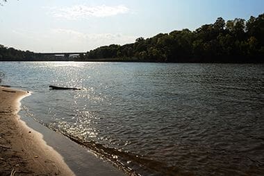
Mississippi River Gorge
Get right next to the Mississippi River.
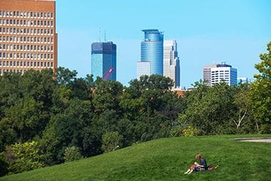
Downtown Minneapolis
Just across the river, past the Cedar-Riverside neighborhood, is downtown.
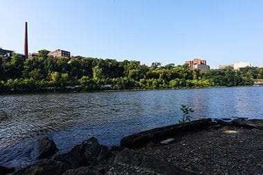
U of M West Bank
Just across the river is the West Bank of the Minneapolis campus.

East River Flats Park
Take a break along the Mississippi!
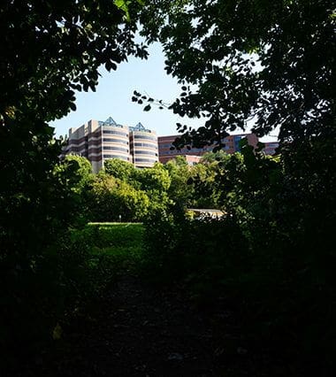
U of M East Bank
East River Flats is just south of the University of Minnesota East Bank campus.

Youth Programs
Sign up for rowing classes!
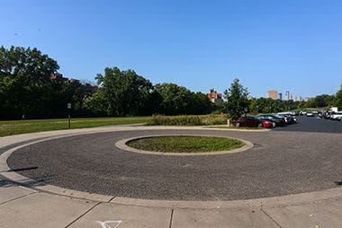
Pay Parking Lot
Park at East River Flats to spend a day along the Mississippi Gorge Regional Park.
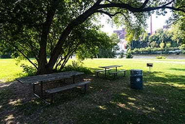
Picnic Area
While the Picnic Areas here are a first-come-first-serve basis, the Park Board has several reservable picnic sites to host your birthday parties and other celebrations.
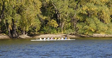
U of M Crew
The park is the site of the boathouse for the U of M women’s rowing team.
Park Board Announcements
There are no announcements at this time. Please check back soon.