


Lake Hiawatha Park
Address
2701 E 44th St.
Minneapolis, MN 55406
Plan Your Route
Contact
General: 612-230-6400
Rec Center: 612-370-4930 Email: info@minneapolisparks.org
Park Hours
6 am-midnight in developed areas
6 am-10 pm in undeveloped areas
Ordinance PB-2-33
Recreation Center
Lake Hiawatha Recreation Center Information and Hours
View Photo GalleryLake Hiawatha Park
Part of: Nokomis-Hiawatha Regional Park
Wading Pool Information
Ice Rink Information
Go to the ice rinks page for details on daily hours, dates for the current season, daily status and temporary closures, a full list of locations and more.Features & Amenities
- Basketball Court
- Cross-Country Ski Trail
- Drinking Fountain
- Driving Range
- Fishing Pier
- Golf Course
- Hockey Rink
- Horseshoe Pit
- Ice Skating Rink
- Little Free Library
- Picnic Area
- Playground/Tot Lot
- Public Art
- Restroom Facility
- Soccer Field
- Softball Field
- Tennis Court
- Wading Pool
- Walking Path
Good to Know
Cross-Country Ski Trail: 2.5 miles Fishing Pier located at the intersection of 27th Avenue South and East 47th Street.
Park Projects
This park will be affected by park improvement projects. View Lake Hiawatha Park Playground Improvement Project and Nokomis-Hiawatha Regional Park Connectivity Improvements.

Park Details
Size: 241.08 acres, including 54.53 acres of water and 140 acres of golf course
Neighborhood: Ericsson
Service Area: South
The “Listening Vessel” sculpture by Minneapolis artist Craig Davis was dedicated in 2009, and is located on the North side of the recreation center. It’s a granite sculpture depicting a parabola – an interactive listening device in the shape of a concave semi-sphere. The sounds from the lake, such as wind, waves, waterfowl and other sounds of the city are amplified to the listener’s ear. The work encourages viewers to explore the natural environment of Lake Hiawatha, as well as their own inner musings and imagination. The sculpture measures 74” x 120” x 24”.
The sculpture is a joint project of the City of Minneapolis Art in Public Places, Minneapolis Arts Commission, Minneapolis Park and Recreation Board and Standish Ericsson Neighborhood Association.
Lake Info
Lake Hiawatha is monitored as part of the Minneapolis Park & Recreation Board’s (MPRB) lake water quality monitoring program.
Click here for MPRB lake monitoring info
The Minnesota Department of Natural Resources has details regarding the size, shore length, depth, and other features of the lake.
Rentals & Permits
Athletic Rentals: Call the recreation center directly to reserve a field, court, or rink for a single practice or game. Visit Recreation Center Rentals for details.
Recurring Athletic Rentals: To reserve a field, court, or rink for two or more dates, visit our athletic permit page.
Outdoor Use and Event Space: Learn how to reserve park space for corporate events, community celebrations, and more.
Canoe/Kayak Storage Rack Permit: An annual permit allows you to store your canoe or kayak. View canoe/kayak permit details.
History
Name: Lake Hiawatha was named for the hero of Henry Wadsworth Longfellow’s epic poem The Song of Hiawatha. The park was officially named Hiawatha Park and the lake, Lake Hiawatha, on November 4, 1925. Previously the lake was referred to as Rice Lake for the wild rice that grew there. In some earlier accounts, particularly in the writing of Charles Loring, the lake was called Mud Lake.
Acquisition and Development
The park board’s first interest in this lake was to get rid of it. In 1891 the park board was intent on ensuring the flow of water in Minnehaha Creek so there would be water over Minnehaha Falls during the 1892 Republican Party Convention to be held in the city. The consensus was that the best way to accomplish that goal was to divert Minnehaha Creek into Lake Nokomis (then known as Lake Amelia) and dam the outlet, using the lake as a reservoir.
Charles Loring, who was the first president of the park board from its creation in 1883 to 1890, wrote in early 1892 that landowners around what he called Mud Lake, but was more commonly referred to as Rice Lake, “would be glad to pay the expense of turning the creek directly into Lake Amelia as they wish to drain their property.”
The park board did authorize park superintendent William Berry to build a dam at the outlet of Rice Lake to control the flow of water in the creek in 1892, but there is no record that the dam was built. (Damming a creek it didn’t own likely would have generated some opposition.)
No action was taken at the time to ensure water in the creek, and with economic depression following the Panic of 1893, the park board would acquire very little property and make very few improvements to land it already owned for the next ten years. When interest increased in obtaining park property in the area in the first years of the 20th century, the focus was on Lake Amelia. The park board finally completed the acquisition of the land around Lake Amelia in 1908 at a cost of $63,500. The park superintendent at that time, Theodore Wirth, later wrote in his history of the park system that Rice Lake could have been acquired at the same time as Lake Nokomis for an additional $25,000. Objections to that purchase included the argument that the patch of swamp could be bought at any time.
In 1910, as plans were presented for a massive dredging and filling operation to reshape Lake Nokomis, Wirth recommended acquiring the land around Rice Lake, redirecting Minnehaha Creek into Lake Nokomis, and filling Rice Lake. A dry meadow, he wrote, would look better than the swampy lake.
Over the next few years, Wirth continued to urge the acquisition of Rice Lake. At that time, he thought all the land that was needed was enough to encompass the water to reduce its size. The board delayed acquisition of the lake because property owners in the area were already paying assessments for the conversion of Lake Amelia into a park—at that time the most expensive single project in the park board’s history.
But another development in Minneapolis parks at that time began to change perceptions of how the land around Rice Lake could be used. In 1916 the park board opened its first golf course at Glenwood (Wirth) Park. The nine-hole course was an immediate success even though it had only sand greens. The course was such a success, and revenue-generator, for the park board that in 1919 the Glenwood course was expanded to eighteen holes and new six-hole course was built at Columbia Park. By 1920 it was evident that the park board needed more golf courses, especially one in the southern section of the city, because both existing courses were in north Minneapolis.
In the 1920 annual report, Wirth suggested that perhaps the only available and affordable land in south Minneapolis that would provide the minimum of 150 acres needed for a golf course was between Rice Lake and Cedar Avenue. The idea caught on. In the next year’s report, board president William Bovey “strongly” advised the board to acquire the land around Rice Lake—but only what was ”absolutely necessary” to provide a suitable golf course and playground. He repeated the advice the following year.
In 1922 the park board followed that advice and designated for acquisition not just Rice Lake, but the land to the west of the lake for a golf course, and the entire valley of Minnehaha Creek from the lake to Minnehaha Falls. While the final acquisition was much larger than contemplated years earlier, so was the price tag. With increasing development of southern Minneapolis, certainly aided by the creation of Lake Nokomis and the surrounding park, Rice Lake was no longer priced as just a swamp. The park board paid $550,000 for the lake, surrounding land and creek bed. Rice Lake had been acquired not to provide a reservoir for Minnehaha Falls, or to be filled in as meadow; it had been acquired in large part to become a golf course. The cost of the acquisition was assessed 100% against “benefited” property over five years, the steepest assessment in park board history not spread in part over property city-wide.
The method of financing the acquisition by local assessment essentially prevented development of the property until it was paid for. The park board didn’t feel it could add an assessment for developing the property on top of the assessment to acquire it. Nonetheless, Wirth submitted his first plan for the property in 1924, which showed the basic layout of the golf course and a playground southeast of the lake. The plan also included a man-made island in the southwest corner of the lake.
In an effort to provide some use of the new parkland that the neighborhood was paying for, in December 1924 the park board responded favorably to petitions from the neighborhood and established the first skating rink on the lake.
Construction of the golf course and dredging of the lake began in 1929 after the assessments for acquiring the property had been paid. Wirth noted that he believed the optimal depth of the lake should be 14 feet and that was approved by the board. His plan to create the island was abandoned, he reported in 1930, when dredging revealed a lack of sand deposits that were needed to build an island. The material dredged from the lake was used primarily to construct rolling terrain needed for a more interesting golf course —more “sporty” was Wirth’s description. Dredging of the lake was completed in 1931 and work began in earnest on the golf course. With the completion of dredging, the beach on the east shore of the lake also opened in 1931.
The final touch to the new golf course was a clubhouse with the appearance of a “very cozy cottage,” according to Wirth, which was constructed in 1932. The same year the golf clubhouse was built a shelter was also built in the northeast corner of the park to serve the playground. Playground equipment was installed in 1931-1932. The tennis courts along Minnehaha Parkway were also built in 1932.
The golf course was finally in playable condition and the first nine holes opened for play July 30, 1934. The charge for playing nine holes was set at $0.35. The full course opened the next summer. Almost immediately, the new course was the only profitable course operated by the park board. While waiting to build the Hiawatha course, the park board had also created two more golf courses, Armour (Gross) and Meadowbrook in the mid-1920s. Both courses enjoyed initial popularity, but with the coming of the Great Depression golf play everywhere dropped off dramatically. Throughout the 1930s, Hiawatha was the only profitable golf course.
The course was heavily used despite repairs several years where fill from dredging had settled and required new fill. In 1939, a federal work relief project added shore walls to prevent erosion at Lake Hiawatha, as had been done at most other city lakes. Park superintendent Christian Bossen explained that shores created by dredging were especially susceptible to erosion from wave action.
One of the only major changes to the layout of the park since it was created was the addition of a second ball field made by filling land north of the lake in 1968. In 1977, the original recreation center was demolished and replaced.
The park did not have full time recreation supervision until 1999, the same year that a Learning Center was added to the golf course northwest of the clubhouse and Tiger Woods made an appearance at the course for the Fairway Foundation and the Minnesota Minority Junior Golf Foundation.
A new accessible playground was built in the park in 2001. The rec center was renovated in 2007, when a computer lab was also opened in the center. Another improvement that year was a new vegetative buffer planted on much of the east shore of the lake. In 2009 the Listening Vessel sculpture was installed. The large granite parabola amplifies sounds from the lake.
In 2010, a new wading pool and splash park were created on the site of the original pool and the four old tennis courts were replaced by five new ones. The new courts were built with assistance from Save the Courts, a non-profit dedicated to rebuilding tennis courts throughout the city.
A new fishing dock was installed on the southeast shore of the lake in 2012, and in 2013 zebra mussels were first detected as a result of the invasive species’ introduction to Minnehaha Creek in prior years.
History through 2008 written by David C. Smith, with updates from 2009 to present written by MPRB.
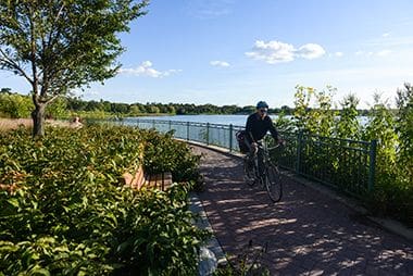
Walking Path
Enjoy a stroll by the lake along Lake Hiawatha Park's paved walking trails.
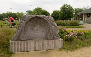
Listening Vessel
With this interactive listening sculpture, the sounds from the lake, such as wind, waves, waterfowl and other sounds of the city are amplified to the listener’s ear.
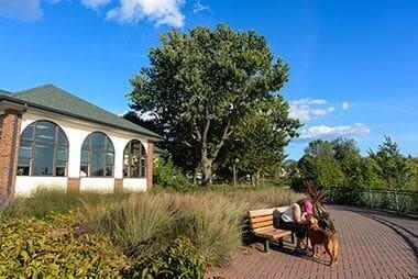
Lake Hiawatha Recreation Center
Lake Hiawatha Recreation Center offers programming year-round.
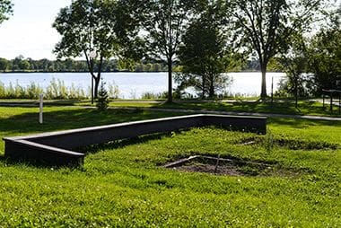
Picnic Area
While the Picnic Areas here are a first-come-first-serve basis, the Park Board has several reservable picnic sites to host your birthday parties and other celebrations.
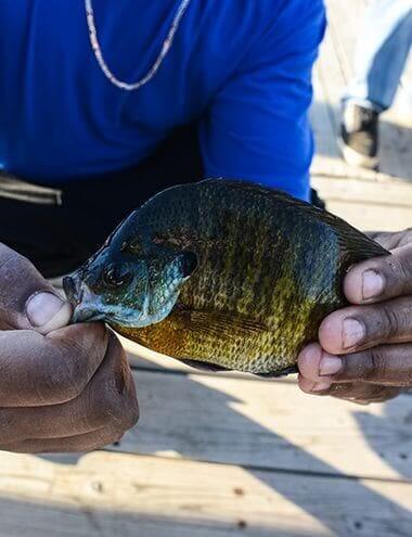
Fishing Pier
Fishing Pier located at the intersection of 27th Avenue South and East 47th Street.
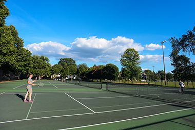
Tennis Court
Sign up for one of our many year-round youth and adults sports leagues.
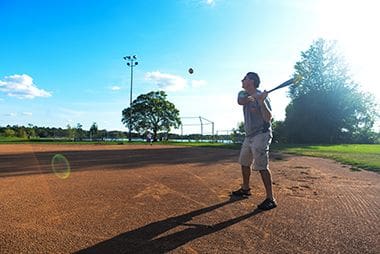
Baseball Field
Sign up for one of our many year-round youth and adults sports leagues.
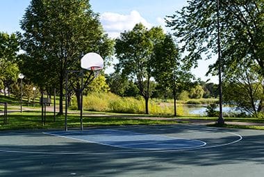
Basketball Court
Sign up for one of our many year-round youth and adults sports leagues.
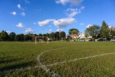
Soccer Field
Sign up for one of our many year-round youth and adults sports leagues.
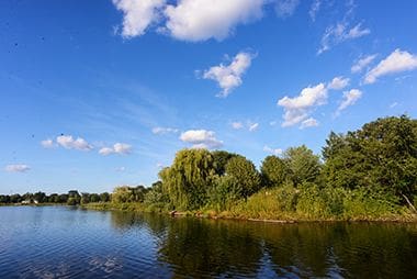
Lake Hiawatha
Lake Hiawatha was named for the hero of Henry Wadsworth Longfellow’s epic poem The Song of Hiawatha.
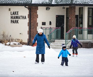
Ice Rink
Lake Hiawatha Park offers outdoor programming year-round with ice skating and hockey in the winter.
Horseshoe Pit
Sign up for one of our many year-round youth and adults sports leagues.
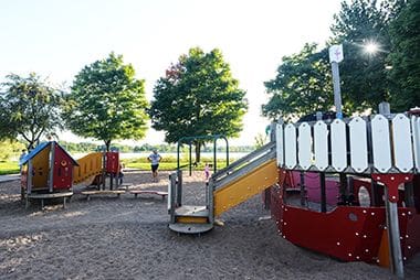
Playground
Enjoy a leisurely day in the park as the kids enjoy themselves on the playground.
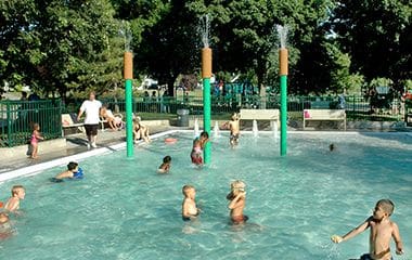
Wading Pool
Cool off in the summer at the Lake Hiawatha Wading Pool. See our other wading pool locations or visit the Lake Hiawatha Beach.
Park Board Announcements
There are no announcements at this time. Please check back soon.