


Bryn Mawr Meadows Park
Address
601 Morgan Ave. S
Minneapolis, MN 55405
Plan Your Route
Contact
Phone: 612-230-6400 Email: info@minneapolisparks.org
Park Hours
6 am–midnight
Ordinance PB-2-33
Wading Pool Information
Bryn Mawr Meadows Park
View Photo GalleryPark Projects
This park will be affected by a park improvement project. View Bryn Mawr Meadows Park Improvements.
Features & Amenities
- Biking Path
- Cricket Field
- Drinking Fountain
- Grill
- Picnic Area
- Playground/Tot Lot
- Restroom Facility
- Soccer Field
- Softball Field
- Sports Facility
- Tennis Court
- Wading Pool
- Walking Path
Good to Know
- Bassett’s Creek Trail (runs through park)
- Cedar Lake Regional Trail
- Luce Line Regional Trail
Picnic Areas are non-reservable.
![]() Your NPP20 money at work: Maintenance is increasing at all neighborhood parks, thanks to additional annual funding from the 20-Year Neighborhood Park Plan (NPP20). This initiative also funds ongoing rehabilitation and major project to restore neighborhood parks and help address racial and economic equity. Find Out More
Your NPP20 money at work: Maintenance is increasing at all neighborhood parks, thanks to additional annual funding from the 20-Year Neighborhood Park Plan (NPP20). This initiative also funds ongoing rehabilitation and major project to restore neighborhood parks and help address racial and economic equity. Find Out More
Park Details
Size: 51.56 acres Neighborhood: Bryn-Mawr Service Area: Southwest Commissioner District: 4
Rentals & Permits
History
Name: The neighborhood and the park named Bryn Mawr take their names from John Oswald’s farm that once occupied that region of the city. Bryn Mawr means “great hill” in Welsh. As early as the 1860s, Oswald grew tobacco on his farm and also produced fruit wines there, which led eventually to Oswald establishing the first wholesale wine and liquor business in Minneapolis. Oswald was a commissioner on the first park board created by the legislature in 1883. The name was officially adopted May 11, 1911.
Acquisition and Development: John Oswald’s son-in-law and business partner, Theophil Basting, offered to sell part of Oswald’s estate to the park board in 1910. Theodore Wirth’s assessment of the property at the time was that it did not offer any “special advantage” except as part of a parkway to connect The Parade and Loring Park to Glenwood (Wirth) Park through Bassett’s Creek Valley. Even then, Wirth reported in 1910 that compared with other needs in the park system it was of “little importance.” The 45 acres originally offered to the park board was appraised at $81,203 in late 1910, a sum the park board was not inclined to pay. For the 39 acres eventually acquired in early 1911, the park board paid only $32,000.
The land left out of the purchase was the far western end that would have connected Bryn Mawr to Glenwood Park, which meant the park board bought the land without a connection to Glenwood—and therefore no Valley Drive. Perhaps the park board was convinced to acquire the land when Bastil and other residents said they would not ask for any improvements on the land. The cost of the purchase was assessed on property in the neighborhood.
The first suggestions for improvement of the land, nonetheless, were made in 1915 when Wirth recommended converting the land into an equestrian center, complete with horse-riding park and polo grounds. The plan was never pursued despite being presented again by Wirth in 1924. At that time he recommended a neighborhood and city-wide assessment to pay for the development. The park board did approve a baseball field for Bryn Mawr, at a cost of $3,000, in 1922, but never approved the equestrian center.
Bryn Mawr was targeted for a neighborhood playground in a 1928 report produced by Wirth. A year later Wirth presented a plan to improve the 39 acres of “almost useless” land. The plan included the improvement of Bassett’s Creek from Glenwood to Bryn Mawr. Sixty acres of land along Bassett’s Creek from Bryn Mawr to Glenwood (Wirth) Park was acquired in 1934 for $14,000. Included in that acquisition were about 14 acres donated by the Glenwood-Inglewood Company and Arthur Fruen, a city council member and ex-officio park commissioner 1929-1933. (See Bassett’s Creek Park).
The first building constructed at Bryn Mawr was a combined toilet building and storage shed to serve the athletic fields in 1953. In addition, about 7,000 yards of clay were removed from the playing field areas and replaced with a good grade of back fill. A small part of Bryn Mawr was lost to freeway construction in 1966, but freeways ultimately resulted in the enlargement of the park. Seven athletic fields at The Parade were lost due to freeway expansion and the park board replaced some of that loss by expanding Bryn Mawr and building more playing fields there.
Important renovations were made to Bryn Mawr’s playing fields in 1992. Bryn Mawr was connected to the Luce Line bicycle trail in 2005, which connected paths from Wirth Park with the Cedar Lake Trail and links to downtown Minneapolis.
From 2021-2023, a major redesign and improvements project, using funds from the 20-Year Neighborhood Park Plan, transformed the park. The main objective was to balance recreation with naturalized areas and sustainability features. Native plants and grasses replaced nine and a half acres of playing fields and lawn, creating a stormwater greenway and a meadow to be used for ice rinks in winter. Those areas connect to dual stormwater ponds funded, designed and constructed by the Bassett Creek Watershed Management Commission. Six acres of lawn were re-seeded with pollinator-friendly “bee lawn” turf, and two new premier playing fields were constructed. Additional features included a new playground, mountain-bike skills course, and over a mile and a half of new trails.
History through 2008 by David C. Smith; updates from 2009 to present by MPRB staff.
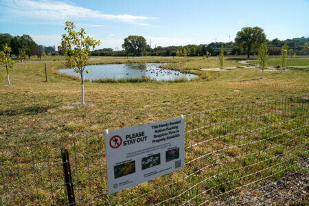
Naturalized park area with stormwater ponds
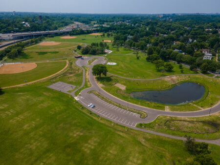
Aerial view
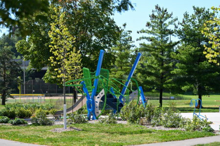
Playground

Playground
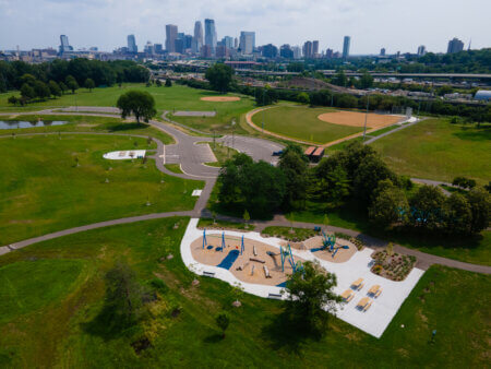
Bryn Mawr Meadows Park
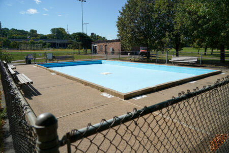
Wading pool
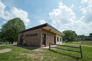
Restroom Facility
Stop by Bryn Mawr Meadows Park while traveling on the nearby Bassett Creek Trail, Cedar Lake Regional Trail, or Luce Line Trail.
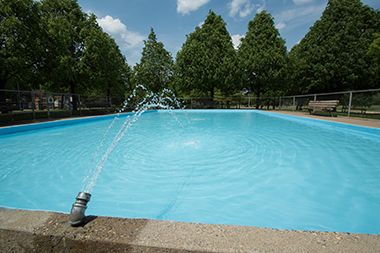
Wading Pool
Cool off in the summer at the Bryn Mawr Meadows Wading Pool. See our other wading pool locations.
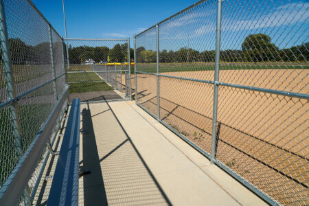
Batting cage
Park Board Announcements
There are no announcements at this time. Please check back soon.