


Kenwood Park
Address
2101 W Franklin Ave.
Minneapolis, MN 55405
Plan Your Route
Contact
General: 612-230-6400
Rec Center: 612-370-4941
Email: info@minneapolisparks.org
Park Hours
6 am–midnight
Ordinance PB-2-33
Recreation Center
Kenwood Recreation Center Information and Hours
View Photo GalleryFeatures & Amenities
- Drinking Fountain
- Grill
- Little Free Library
- Picnic Area
- Playground/Tot Lot
- Restroom Facility
- Softball Field
- Tennis Court
- Walking Path
Not finding what you’re looking for?
Search Parks & Destinations
![]()
Your NPP20 money at work:
Maintenance is increasing at all neighborhood parks, thanks to additional annual funding from the 20-Year Neighborhood Park Plan (NPP20). This initiative also funds ongoing rehabilitation and major project to restore neighborhood parks and help address racial and economic equity.
Park Details
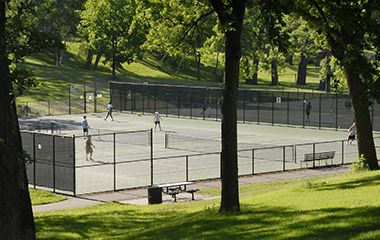
A significant achievement in recent years (2007) was the two-year fundraising and renovation project of the Kenwood Tennis Courts, the Park Board’s largest bank of public tennis courts. The project was the result of a unique partnership between the MPRB, the USTA and the Kenwood Isles Tennis Association’s “Support The Courts” organization.
Rental & Permits
Athletic Rentals: Call the recreation center directly to reserve a field, court, or rink for a single practice or game. Visit Recreation Center Rentals for details.
Recurring Athletic Rentals: To reserve a field, court, or rink for two or more dates, visit our athletic permit page.
Outdoor Use and Event Space: Learn how to reserve park space for corporate events, community celebrations, and more.
History
Name: The park was named for its location in the Kenwood district.
Acquisition and Development
The land for Kenwood Park was designated for purchase on March 4, 1907. The acquisition came in response to a request from the Kenwood and Greenview Improvement Association that the board acquire the low land north of Lake of the Isles for a park. Upon the recommendation of the superintendent of parks, Theodore Wirth, the board acquired more than just the low lands. The land acquired extended up the hill north of the lake to Mt. Curve Boulevard. The purchase price of the land was nearly $162,000, with the entire amount assessed to property in the district around the park.
One reason for Wirth’s recommendation was evident in the plan he published for the park in the 1907 annual report. The most important feature of that plan was a promenade at the upper end of the park that would overlook the lakes in the distance. Wirth called the view “simply superb” and said it would form “a very agreeable and fascinating surprise” to anyone coming up the Kenwood Parkway hill from the north. He said no recent acquisition was of greater value to the park system than Kenwood Park and that such scenery in the “very heart of a beautiful residential district is indeed a rare gift.” Wirth wrote that the aim of his plan was to preserve all natural features of the park “which so well harmonize with the scenic lake below.”
In addition to the concourse at the top of the park, which would project out into the park and be built of heavy masonry, Wirth’s plan included basketball and croquet courts in the low land near the lake, tennis courts on the relatively flat ground just south of Douglas Avenue and roque courts north of Douglas below the proposed promenade and concourse.
Wirth presented his plan, he wrote, without expectation to have it carried out in the near future, but with the hope that it would be “in the main adopted and adhered to when improvements are possible.” More than one hundred years later, the park remains largely as it was when Wirth created his first plan for the park. With the exception of tennis courts, a small playground and a small baseball field the “natural features” of the park have been preserved much as they were.
Five years after Wirth presented his plan, the park board paid more than $4,000 to haul in nearly 13,000 cubic yards of fill for the low land between Franklin and Douglas. Part of that fill near Douglas Avenue permitted the construction of tennis courts in 1913. At the time Wirth noted a “persistent” demand for improvement of the park and added that the “valuable tract” could not be left much longer in its “unimproved and very much torn up condition.” Wirth would repeat his call for improvements constantly in his annual reports for nearly two decades largely because the park was an eyesore in one of the “finest residential districts.”
A bridle path through the park was created in 1914, but Wirth’s call for a ball field in the park that year went unheeded. Part of the problem in developing the park was water: the city sewer line ran under the park and heavy rains popped manhole covers and flooded the low lands in the park. Even when the park board added four tennis courts near Franklin Avenue in 1916, Wirth wrote in the annual report that the priority should be to build a storm sewer to carry water out of the park into Lake of the Isles. The flooding problem might have been particularly nasty because in most of the city at the time sanitary and storm sewers were not separated.
Finally in 1919, with the assessments to purchase the land already paid off, the park board considered new plans and estimates to develop the park. That year the park board denied a request from the Kenwood School PTA for playgrounds and ballfields across Franklin Avenue from the school because they would be part of a new overall plan to improve the park that was being prepared. That plan went nowhere and Wirth revised his plan for the park again in 1921. That plan included a shelter building in the center of the park. Minor improvements were made in 1922 when the bridle path was repaired and in 1923 when the park board accepted $200 from the Kenwood PTA to level the park land across from the school so it could be used as a “recess playground.”
In 1924 Wirth repeated his suggestion for improving the park and wrote once again that the “unserviceable condition” of the park was “more noticeable and offensive for being in a fine residential district.” With the presentation of another plan for the park in the 1925 annual report, Wirth urged that if the people of the neighborhood didn’t petition for the improvements, the board should improve the park on its own initiative. (A new wrinkle in Wirth’s 1925 report indicated the success of the four golf courses the park board had built at that time. He suggested a small, circular or “clock” golf course along Franklin Avenue.)
One reason for the lack of improvements to the park over the years was revealed in the 1926 annual report, in which Wirth wrote that the residents of the area had been convinced finally that the plans for the park were conducive to the preservation, rather than the destruction, of the natural features of the property. Improvement of the park was ordered that year by the park board at an estimated cost of $117,000, but Wirth noted that, after conferring with residents, the plans were slightly modified. The next year he modified the plans again and his exasperation showed when he wrote that the changes were made to meet objections to the introduction of playground features and other accommodations in the park that were, in Wirth’s words, “universally considered necessary and desirable” for a neighborhood park in a residential district.
Finally in 1928, Wirth’s greatly reduced plan for the park, at a cost of $55,000 instead of the $117,000 of a few years earlier, was implemented. Property owners in the area were assessed the cost. Most of the cost was to build six new tennis courts and to grade and plant trees and shrubs in parts of the park. No recreation shelter and no ball fields were built. And Wirth’s plan for a concourse at the top of the park, although included in every plan he produced for the park over the years, was apparently never seriously considered.
These were the last improvements to the park until 1960, when three tennis courts were replaced due to poor subsoil conditions, as the board’s annual report put it.
The next park board investment in the park was in the early 1980s. When the school board decided to renovate and expand Kenwood School, the park board was invited to look at the project and decide if it wanted to add space to the plans for park activities. (In 1971 the park board and school board had agreed to develop two projects together. The park board agreed to build a gym attached to Burroughs School across from Lynnhurst Park, which the school could use in return for park use of a gym that the school board would build at Kenwood School. The school board shelved its part of the bargain for many years until it decided it needed more space at Kenwood School anyway.)
The park board recommended adding a multi-purpose room, a game room and arts and craft space, arranged in such a way that park programs would also have access to the gym. The catch was that adding park board space to the school plans required a slight redirection of Franklin Avenue in front of the school. After lengthy discussion, lawsuits and continuing opposition from some in the neighborhood, the plans went forward and the park board finally had a building for activities at Kenwood Park, although not on park property. The center at Kenwood was the last, most-embattled project in more than a decade of park construction throughout the city
In 1996 a new playground was installed in the park across from the school and in 2006 the small ball field nearby was improved. In 2007 the tennis courts in the park were redeveloped through the efforts and fundraising of Save the Courts, a non-profit organization committed to upgrading tennis facilities in several city parks.
The “totlot” in the corner of the park was renovated in 2010 and the community center at Kenwood Park was upgraded in 2014. When the community center was upgraded the park board also extended its agreement with the school board for continued joint use of the building.
History through 2008 written by David C. Smith, with updates from 2009 to present written by MPRB.
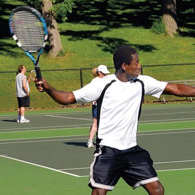
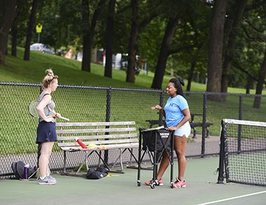
Tennis Players
Tennis Players on Court
The Kenwood Tennis Courts are the Park Board's largest bank of public tennis courts.
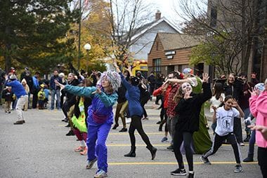
Halloween at Kenwood
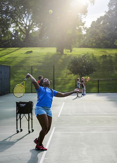
Adult Tennis Lessons Serving
Sign up for one of our many year-round youth and adults sports leagues.
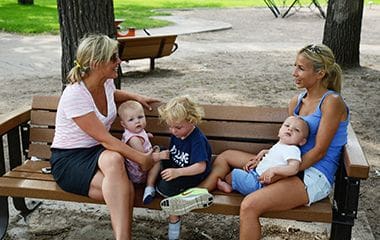
Friends on a Playground Bench
Enjoy a leisurely day in the park as the kids enjoy themselves on the playground.
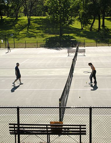
Adult Tennis Lessons
The Kenwood Tennis Courts are the Park Board's largest bank of public tennis courts.
Softball Field
Sign up for one of our many year-round youth and adults sports leagues.
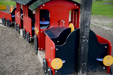
Playground
Kenwood Park features a tot lot for the smallest family members.

Halloween Party-Goers at Kenwood
Tennis Courts
Call the recreation center directly to reserve a field, court, or rink for a single practice or game.
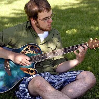
Musician Playing Guitar at Kenwood Park
Relax and take a break in Kenwood Park.
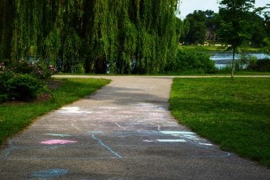
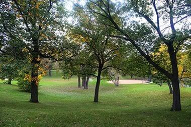
Walking Path
Enjoy a shady stroll and views of Lake of the Isles along Kenwood Park's paved walking trails.
Park Board Announcements
There are no announcements at this time. Please check back soon.