


Park Siding Park
Address
3113 W 28th St.
Minneapolis, MN 55416
Plan Your Route
Contact
Phone: 612-230-6400
Email: info@minneapolisparks.org
Park Hours
6 am-midnight
Ordinance PB-2-33
Features & Amenities
- Drinking Fountain
- Grill
- Picnic Area
- Playground/Tot Lot
- Garden
Become a garden volunteer! Email sbrooks@minneapolisparks.org
Not finding what you’re looking for?
Search Parks & Destinations
Good to Know
Nearby Trails:
- Grand Rounds National Scenic Byway
- Kenilworth Trail
- Midway Greenway
Park Projects
See what’s currently in the works for this park. Some projects may be under the name of the regional park or service area it lives within. View Current Projects
![]()
Your NPP20 money at work:
Maintenance is increasing at all neighborhood parks, thanks to additional annual funding from the 20-Year Neighborhood Park Plan (NPP20). This initiative also funds ongoing rehabilitation and major project to restore neighborhood parks and help address racial and economic equity.
Park Details
Rentals & Permits
Outdoor Use and Event Space: Learn how to reserve park space for corporate events, community celebrations, and more.
History
Name: The park name, adopted November 4, 1925, was chosen because the property was adjacent to the railroad track just west of Dean Boulevard. From 1916, when the park board first leased the property, it was referred to as the Dean Boulevard Construction Yard or the Nelson Tract after the name of the company that sold the land to the park board.
Acquisition and Development
The original property of three acres was purchased June 4, 1919 from the Nelson Brothers Paving and Construction Company for $26,200, payable over ten years.
The property was acquired to provide a storage and work yard, primarily as a paving plant for parkway construction. The board first leased the space for that purpose in 1916, but park superintendent Theodore Wirth presented a drawing of the proposed location and arrangement of an “asphalt plant and storage yard” at that location in his 1915 annual report. At that time Wirth estimated that the pavement required for the entire system at the time was one million square yards, a volume that would be handled more economically with a modern plant. He noted that he already had a portable plant located on the Nelson Brothers’ land before the lease was negotiated. After only a year of operating under the lease, Wirth recommended in June, 1917 that the land be purchased.
The park board initially agreed to pay $32,000 for the property in 1918, but backed out of that deal and was sued by Nelson Brothers to enforce the agreement. The court determined that the agreement was not a valid contract and the Nelson Brothers and the park board compromised on a purchase price of $26,200.
Wirth wrote in his 1919 annual report that the location provided excellent railroad track facilities for off-loading supplies, and space for shops, storehouses and yards. Perhaps what he left out is most telling, and may have contributed to the board’s reluctance to proceed with the acquisition at the original price: asphalt. Wirth’s plans for an asphalt plant were obviated by his conclusion that an asphalt-concrete mix for parkways was less durable and more expensive than tar macadam. By 1920 it was obvious that the asphalt-concrete mix used on The Mall and King’s Highway was already in need of repairs. Wirth also made the case in his 1920 report that “asphaltic concrete” was two to three times more expensive than tar macadam. His opinion had shifted dramatically from 1916, when he emphasized the need for an asphalt plant, to 1920 when he stated the standard pavement for the park system would be a tar macadam surface.
Wirth’s plan when the board finally acquired the railroad siding was to lower the ground near the track by six feet and use the excavated gravel and sand in the Grand Rounds construction projects then in planning stages. He speculated that the value of that material would more than cover the cost of the acquisition. He further noted that the new machinery for grading, ditching and paving to be used in constructing the Glenwood-Camden Parkway, among others, had been received and was housed in an old building on the property.
This was at a time when extensive road-building had begun on the Glenwood-Camden Parkway, soon to be followed by either paving or construction at Linden Hills Boulevard, Stinson Boulevard, St. Anthony Parkway, Minnehaha Parkway and West Lake Calhoun Parkway.
For accounting purposes, improvements to the property were charged against the park construction fund, rather than the property itself, and are therefore difficult to track from park board reports. The board did contract with the railroad in 1923 to extend the storage tracks on the property.
Wirth wrote in 1926 that the value of the property to the park board was steadily increasing. The location of the yard was especially useful for additional road construction on Minnehaha Parkway and the west side of Lake Calhoun.
A small piece of the property was leased to a private citizen in 1933 and by the 1950’s, with the exception of a playground for young children, the land was largely unused. The park board staff recommended in the 1950s that the property be sold. In 1971, a developer was interested in buying the property and, with the required permission from the District Court to sell the land, it was advertised for sale. The only bidder was the developer who purchased 1.3 acres of the property for $150,000.
A proposal to rename the park Woodcarvers Park, in 1977, in exchange for the donation of three 25-foot totem or heritage poles for the park was not accepted by the park board. The park was referred to informally by park staff as Woodcarvers Park anyway because of the woodcarving shop and school across the street from the park.
When the park board completely renovated the little park in 1997—which was by then nowhere near a working railroad track—it won a design award from the Committee on Urban Environment. The renovation was financed in part by Cedar-Isles-Dean neighborhood revitalization funds. In 2012 the Cedar Isles Dean neighborhood paid for new trees, redesigned garden beds with new irrigation systems and two concrete outdoor table tennis tables.
Today the tranquil little park, nestled on a dead-end street among modern townhouses, lies beside not a railroad track, but a bicycle and pedestrian path. No longer a place to unload railcars, it’s an excellent place for a breather for cyclists who travel the path the trains once did. No hint remains of the muscular work of mixing asphalt and building roads.
History through 2008 written by David C. Smith, with updates from 2009 to present written by MPRB.

Siding Park Playground
Enjoy a leisurely day in the park as the kids enjoy themselves on the playground.
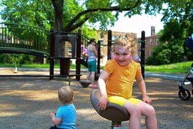
Playground
Enjoy a leisurely day in the park as the kids enjoy themselves on the playground.
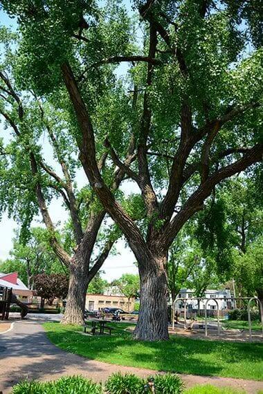
Picnic Area
While the Picnic Areas here are a first-come-first-serve basis, the Park Board has several reservable picnic sites to host your birthday parties and other celebrations.

Wildflowers
Park Board Announcements
There are no announcements at this time. Please check back soon.