


Bassett’s Creek Park
Address
110 Penn Ave. N
Minneapolis, MN 55405
Plan Your Route
Contact
General: 612-230-6400
Email: info@minneapolisparks.org
Bassett's Creek Park
Nearby Recreation Center: Harrison Recreation Center
Features & Amenities
- Biking Path
- Playground/Tot Lot
- Soccer Field
- Softball Field
- Sports Facility
- Picnic Tables
- Bike Racks
- Tennis Court
- Volleyball Court
- Walking Path
Not finding what you’re looking for?
Search Parks & Destinations
Good to Know
Nearby Trails:
- Cedar Lake Regional Trail
- Luce Line Regional Trail
While the creek is known as Bassett Creek, the park’s official name is Bassett’s Creek Park.
![]()
Your NPP20 money at work:
Maintenance is increasing at all neighborhood parks, thanks to additional annual funding from the 20-Year Neighborhood Park Plan (NPP20). This initiative also funds ongoing rehabilitation and major projects to restore neighborhood parks and help address racial and economic equity. Find Out More
Park Details
Size: 70.26 acres
Neighborhood: Harrison and Bryn-Mawr
Service Area: North and Southwest
Commissioner District: 2 and 4
The Luce Line Trail is a commuter biking trail that runs along Bassett Creek. It passes through Theodore Wirth Park to the West, and eventually reaches the city of Cosmos in west-central Minnesota. Going Southeast, the trail connects to nearby Bryn Mawr Park where the Cedar Lake Trail also meets. The Cedar Lake Trail travels from Hopkins to downtown Minneapolis.
Rentals & Permits
Athletic Rentals: To reserve a field, court, or rink visit our athletic permit page.
Outdoor Use and Event Space: Learn how to reserve park space for corporate events, community celebrations, and more.
History
Name: The park is named for the creek that meanders from Medicine Lake in Plymouth through Golden Valley, Theodore Wirth Park and Minneapolis to the Mississippi River. The creek was named for Joel Bassett, the first settler on the creek’s banks, a member of the city council in 1872, and the first judge of probate in Hennepin County.
Acquisition and Development
The first land for the park along Bassett Creek between Bryn Mawr Park and Theodore Wirth Park was acquired in 1930 when Arthur Fruen and the Glenwood-Inglewood Company donated 13.4 acres for a park along the creek. Fruen was a city council member and ex-officio park commissioner at the time. In 1934 the park board purchased 43 acres to expand the park.
The land was almost acquired, however, many years earlier. When Bryn Mawr Meadow, part of the estate of John Oswald, one of the original park commissioners, was purchased from his heirs in 1911 the park board had considered acquiring the valley of Bassett Creek all the way to Glenwood (Wirth) Park. At that time it was considered a possible parkway route from Loring Park through The Parade and Bryn Mawr to Glenwood Park. In the end the board acquired Bryn Mawr Meadow only as far west as Cedar Lake Road.
Interest in Bassett Creek surfaced again in 1924 when park superintendent Theodore Wirth made a survey of the area. He wrote in the 1924 annual report that he believed the land should be owned by the park board and suggested that the “unsightly and unsanitary” land could be made attractive at “comparatively small expense.” Opposition to the plan by residents of the area however dissuaded the park board from pursuing the issue.
Wirth noted in 1929 that the idea of acquiring the creek had been revived and he submitted a plan for the development of the potential park in the 1929 annual report. In June 1930 the Fruen family and the Glenwood-Inglewood Company offered to donate more than 13 acres along the creek for the park and delivered deeds to the land in December 1930. Over the next three years, the park board and residents of the area debated how much land should be purchased to add to the donated land and how the cost would be assessed to property owners. Assessing property owners for anything during the Great Depression met with opposition. In February 1934 the park board designated 43 acres of land for purchase. The price was less than $14,000, which was assessed on property in the district. It was one of the park board’s few land acquisitions from the beginning of the depression until after World War II.
Improvements to the land began almost immediately using labor from federal work relief programs. The land at an old dump at Russell and 2nd Avenue North was raised about five feet and converted into a five-acre ball field. The creek bed was cleaned between Penn and 6th Avenues North and, where the banks of the creek were steep, stone walls were constructed. In addition a concrete dam was built near the Fruen Mill. The land north of Glenwood Avenue and east of the creek, which had previously been a dump, was graded. Similar work continued in 1935, still with federal assistance, included the deepening of the creek. In 1936, four clay tennis courts were added to the park, two near Glenwood Avenue and two near Chestnut Avenue. Federally funded improvements continued in 1937, most notably the creation of two lagoons.
The park was enlarged in 1944 by more than three acres when the park board agreed to swap two acres of park for more than five acres of railroad land beside the park.
Following the initial improvements to the park with federal funding, very few improvements were made to the park for many years. The next time that Bassett Creek featured in park plans was in the 1950s when the water flow in the creek was coveted to raise the water levels in the Chain of Lakes to the south. Unlike Minnehaha Creek, Bassett Creek never seemed to run out of water, so it was considered the best source for more water in the lakes. In 1958 a pipeline and pump were constructed from Bassett Creek to Brownie Lake. Water pumped into Brownie Lake flowed into Cedar Lake, Lake of Isles, and Lake Calhoun, and eventually reached Lake Harriet.
The new pumping station succeeded in raising the levels of those lakes more than four inches in 1958, but that wasn’t enough. After examining several alternatives, including capturing water from air conditioners in downtown office buildings for pumping into the lakes, the park board built a pipeline to the Mississippi River to pump river water to the Bassett Creek pumping station and from there to the lakes. That pump began operation in 1966 and continued periodically through the 1970s and 1980s.
Another ball field was constructed in the park near Thomas Avenue in 1968 when a swampy section of land was filled. An offer of free fill from a local contractor proved too attractive to pass up. Additional improvements to the park, including the addition of a “totlot,” were completed in 1990.
The most recent changes in the park began in 1996 with the creation of a commuter biking trail through the park to connect to Bryn Mawr Park and the Cedar Lake Trail to downtown. The last connection of biking trails occurred in 2002 when the Luce Line Trail was connected through Wirth Park to the Bassett Creek Trail.
The Bassett Creek Bike Trail running through the park was created in 1996 to connect to Bryn Mawr Park and the Cedar Lake Trail to downtown. The last connection of biking trails occurred in 2002 when the Luce Line Trail was connected through Wirth Park to the Bassett Creek Trail.
In 2015 the park board traded an 11,420-square-foot parcel of land adjacent to the abandoned Fruen Mill property to a developer for an identically-sized parcel of land nearby to help develop a long-vacant nuisance property next to the park.
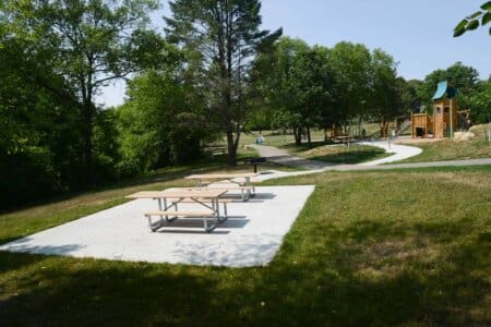
A new playground opened in 2018 on the park’s west side, near Chestnut Avenue; other west-side improvements included an accessible path, picnic tables, benches, bike racks and native plantings. Additional improvements constructed in 2020 on the park’s east/north side (in the Harrison neighborhood) included another playground with native plantings, picnic tables and a grill. These projects were among the first funded by the 20-Year Neighborhood Park Plan, approved in 2016 by MPRB and the City of Minneapolis.
History through 2008 by David C. Smith, with updates from 2009 to present by MPRB.
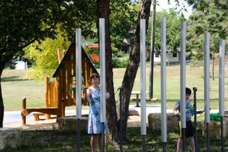
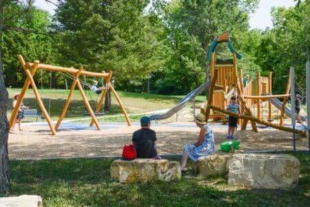
Music in Playground at Bassett's Creek Park in Minneapolis
Playground completed in 2021 on the park's east side, near Chestnut Ave. & Morgan Ave. N.
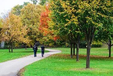
Bassett's Creek Park in the Fall
Learn how to reserve park space for corporate events, community celebrations, and more.
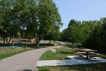
Bassett's Creek Park Trail and Picnic Area
Picnic tables and bike racks added as part of an improvements project
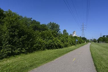
Bike Trails
The Luce Line Regional Trail and Cedar Lake Regional Trail run near Bassett Creek Park.
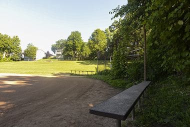
Picnic Area
Picnic tables, bike racks added during a 2020-21 improvements project on the park's east side
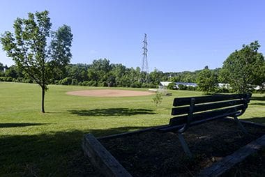
Bassett's Creek Park Bench and Softball Field
Learn how to reserve park space for corporate events, community celebrations, and more.
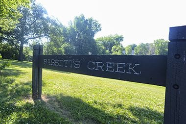
Bassett's Creek Park Sign
The park is named for the creek that meanders from Medicine Lake in Plymouth through Golden Valley, Theodore Wirth Park and Minneapolis to the Mississippi River.
Softball Field
Athletic fields at Bassett Creek Park are reservable.
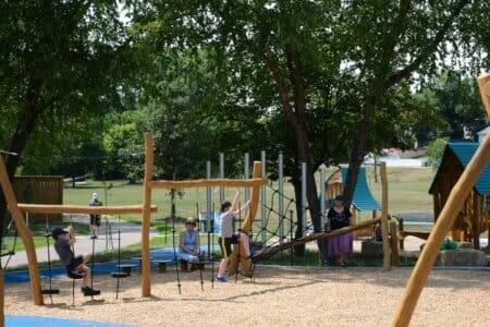
Children on Playground at Bassett's Creek Park
Playground completed in 2021 on the park's east side, near Chestnut Ave. & Morgan Ave. N.
Playground at Bassett's Creek Park in Minneapolis
Playground completed in 2021 on the park's east side, near Chestnut Ave. & Morgan Ave. N.
Park Board Announcements
There are no announcements at this time. Please check back soon.