Contact

Phone: 612-230-6400
Email: info@minneapolisparks.org

Park Hours

6 am–midnight
Ordinance PB-2-33

Triangles & Other Tiny Parks

View Photo Gallery

Your drive, bike ride or stroll around Minneapolis will take you past many picturesque lakes and parks with recreation centers, playgrounds, gardens, athletic fields and picnic shelters. But you will also encounter little patches of green space tucked between buildings, on street corners and even in the middle of a block.

Commonly referred to as triangles or city squares, these are small parcels of land owned by the Park Board. They are intended to provide an attractive neighborhood focal point. Generally small in size, these little patches of land are usually limited to aesthetics development or maintained in a natural state. A few Triangle Parks, including Bedford Triangle, Vineland Triangle, and Clifton Triangle, have been paved over.

Minneapolis Park and Recreation Board properties include has 37 Triangles, one Circle and one Oval.

See what’s currently in the works for these parks. Some projects may be under the name of the regional park or service area they live within. View Current Projects

8th Avenue Streamscape

8th Avenue North between 5th Street and West River Parkway
Features: Paved trail connection

Details & History

Neighborhood: North Loop

Service Area: Downtown

Commissioner District: 2

History

Name: The 8th Avenue Streamscape got its name from Bassett Creek, which is buried but still flowing underneath downtown Minneapolis along a route that roughly follows 8th Avenue to the Mississippi River.

Acquisition and Development

The 8th Avenue Streamscape is a future linear park that will weave through streets and properties in North Loop neighborhood and connect the Mississippi River to 5th Street N., near the Metro Transit garage.

The vision for a downtown linear park unfolded from the MPRB master planning process for the  Downtown Service Area Master Plan (DSAMP), adopted in 2017. The plan outlined that “downtown needs parks and the chance to fold park-like spaces into the experience of downtown… allowing the pattern to be some combination of public and private spaces better reflects the need for diversity in the experience of downtown.” (page 3-3)

The original route in DSAMP was outlined through identifying potential future public and private opportunities known at that time. Since 2017, it has become clear that the route will shift from the original route based on the actual properties and opportunities that have unfolded between public and private partnerships.

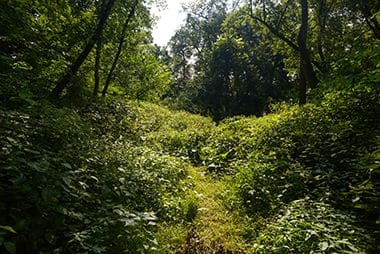
The Riverloop Connection, a Board-approved park dedication land-in-lieu agreement, provides public trails between West River Parkway and 8th Avenue.  It was constructed in the fall of 2020 and is open to the public.

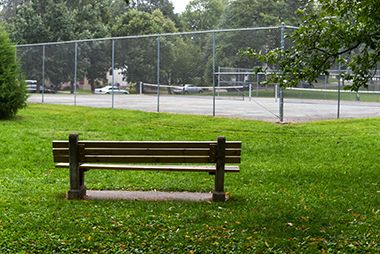
In July 2021, a recently purchased surface parking lot located on 3rd Street N between 7th and 8th Avenues was converted into an open, sodded, green space – the beginning of North Loop’s first neighborhood park.

The Minneapolis Park and Recreation Board has been steadily acquiring land and negotiating easements or other agreements to develop a visible, green connection through the North Loop neighborhood to the Mississippi River since 2017, when the Downtown Service Area Master Plan was approved.

28th Street Tot Lot

175 28th St. E
Features: Playground/Tot Lot

Details & History

Size: 1.14 acres

Neighborhood: Whittier

Service Area: Southwest

Commissioner District: 4

History

Name: The property is named for the street on which it is located.

Acquisition and Development

This small playground – destined to be an empty lot where I-35W angled eastward – was leased from the Minnesota Department of Highways in 1968 at the time the freeway was built. The lease has been renewed periodically ever since. Why did the otherwise straight I-35W veer eastward for northbound travelers at that point? If it hadn’t, the Minneapolis Institute of Arts would have had to be demolished – and that wasn’t going to happen.

The land was first mentioned in park board proceedings on the same date, June 13, 1968,  that the park board voted to fight condemnation by the highway department of Wilson Park, just west of downtown, and North Mississippi Park. Wilson Park was eventually taken by the state for I-94 and North Mississippi Park was subject of negotiations that eventually led to a trade of some lands with the state and the protection of the riverfront park adjacent to Webber Park.

History written by David C. Smith.

Adams Triangle

4100 37th Ave. S
Features: Walking Path

Details & History

Size: 0.32 acres

Neighborhood: Hiawatha

Service Area: South

Commissioner District: 5

Master Plan: After two years of extensive community engagement, the Adams Triangle Master Plan was approved in 2016 as part of the South Service Area Master Plan. The Adams Triangle Master Plan will guide outdoor park improvements at Adams Triangle for the next 20-30 years. Click the link below to view the master plan.

Adams Triangle Master Plan [PDF]

History

Name: Adams Triangle was named in 1921 for Abraham S. Adams a park commissioner 1893-1905 and president of the park board 1903-1905.

Acquisition and Development

Adams Triangle was designated for purchase May 21, 1919. The purchase was completed in 1920 for $2,400. Another $1,800 was spent that year on improvements to the property, including grading and the installation of curbs and gutters—considerably less than the $2,600 the board had allocated for improvements in September 1919. All costs were assessed against property in the surrounding neighborhood.

Park history compiled and written by David C. Smith.

Alcott Triangle

3401 W 29th St.

Details & History

Size: 0.26 acres

Neighborhood: Cedar-Isles-Dean

Service Area: Southwest

Commissioner District: 4

History

Name: The park was presumably named for the Alcott School next to the park. The two-room schoolhouse, built in 1921, was named for American author Louisa May Alcott.

Acquisition and Development

The triangle was platted as a park in the West End Addition in 1887 along with West End Triangle nearby.

On June 10, 1927, the city council voted to turn over the triangle to the park board. The park board received notification of the action at its meeting of June 27. Two months later, however, the park board decided that the property “is apparently of no use as a park.” The park board suggested to the city council that the school board might have some use for the land in conjunction with Alcott School and recommended that the council vest title in the property with the school board. A year later the school board asked the park board for title to the land, but the park board still didn’t officially own the land.

Park board records do not indicate when the park board officially accepted title to the land from the city. The school closed in 1940.

Park history compiled and written by David C. Smith.

Architect Triangle

3559 Architect Ave. NE

Details & History

Size: 0.54 acres

Neighborhood: Columbia Park

Service Area: Northeast

Commissioner District: 1

History

Name: The property was named for its location on Architect Avenue.

Acquisition and Development

Architect Triangle was donated to the city when the land was platted February 15, 1906. The triangle was not officially designated as a park by the park board, however, until March 15, 1933. The action followed petitions the previous year by residents of the neighborhood to have the park board assume responsibility and maintenance of the property. A similar petition had been rejected in 1927. Improvements in 1933 were financed by $900 in city bonds.

Park history compiled and written by David C. Smith.

Bancroft-Meridian Garden

E. 38th St. at 12th Ave. S.

Details & History

Neighborhood: Bancroft

Service Area: Lower South

Commissioner District: 5

History

Also known as the Meridian Garden Food Forest, this community garden is one of several in Minneapolis that are on MPRB-owned land. More information: Bancroft Neighborhood Association, or contact the association.

Barnes Place Triangle

620 Elwood Ave. NE

Details & History

Size: 0.60 acres

Neighborhood: Near-North

Service Area: North

Commissioner District: 2

History

Name: Barnes Place was likely named for William A. Barnes, who along with Elwood S. Corser and C. P. Lovell, donated the property to the park board when they were platting the area for housing. The park board made a minor change in the name from Barnes Park to Barnes Place in 1890.

Acquisition and Development

Barnes Place was tendered to the park board as a donation by Elwood S. Corser, William A. Barnes and C. P. Lovell in June 1887 on the condition that it be graded and fenced during 1887. In July of that year the park board designated the land for acquisition and instructed park superintendent William Berry to improve the grounds once title was secured. At the same time the same group of men donated Lovell Square nearby. Corser had earlier donated property on the shore of Lake of the Isles for parks. Corser and Barnes were often hired by the park board as appraisers for land the board acquired by condemnation.

The 1889 annual report notes that Barnes Place was deeded to the park board in April of that year. It was listed in the inventory at that time as 1.33 acres, but in 1893, the size of Barnes Place was changed to 0.57 acres without any mention of disposition of land.

Barnes Place was originally designed by Horace Cleveland, the landscape architect who provided a blueprint for the entire park system in 1883 and designed most early individual parks. Barnes Place was the smallest park Cleveland designed in Minneapolis.

Initial improvements to the small park were made in 1889, including the closing of Thomas Place which ran through the park.

Park history compiled and written by David C. Smith.

Barton Triangle

90 Barton Ave. SE

Details & History

Size: 0.02 acres

Neighborhood: Prospect Park-East River Road

Service Area: Southeast

Commissioner District: 1

History

Name: The triangle is named for the street on which it is located.

Acquisition and Development

The city council requested on September 24, 1915 that the park board take over four triangles in the Prospect Park neighborhood of southeast Minneapolis, including Barton Triangle. The park board agreed to take control of the triangles October 11, 1915 and officially named them on November 17, 1915. The other three triangles accepted were Bedford, Clarence and Orlin.

The triangle was improved—graded, seeded, planted and curbed—in 1916.

Park history compiled and written by David C. Smith.

Caleb Dorr Circle

8 27th Ave. SE

Details & History

Size: 0.06 acres

Neighborhood: Prospect Park-East River Road

Service Area: Southeast

Commissioner District: 1

History

Name: Unlike the other parcels of land acquired at the same time, Caleb Dorr Circle was the only tract that was given a name that was the least bit creative. While the other four parcels were simply named for the streets on which they were located— Bedford, Barton, Clarence and Orlin—this slightly larger piece of land was named for an early settler of Minneapolis and a pioneer lumberman. Caleb Dorr also had been elected alderman for area in the first St. Anthony city elections in 1855.

It was the only park property in Minneapolis called a “circle.” All the other odd lots of park property at intersections were called triangles, except two “ovals”—Lakeside and Highland, neither of which still exist. The only remaining “oval” in the park system—Seven Oaks Oval near West River Parkway—was acquired in 1922.

Acquisition and Development

The city council requested on September 24, 1915 that the park board take over five parcels of land in southeast Minneapolis, including Caleb Dorr Circle. The park board agreed to take control of the land on October 11, 1915 and officially the parcels on November 17, 1915. The other four parcels accepted were Bedford, Barton, Clarence and Orlin Triangles.

The circle was improved—graded, seeded, planted and curbed—in 1916 along with the four other small triangles in the Prospect Park neighborhood.

Park history compiled and written by David C. Smith.

Chowen Triangle

2735 Chowen Ave. S

Details & History

Size: 0.06 acres

Neighborhood: Cedar-Isles-Dean

Service Area: Southwest

Commissioner District: 4

History

Name: The triangle was named for Chowen Avenue on December 18, 1911.

Acquisition and Development

Chowen Triangle was purchased as a “two-fer.” On October 2, 1911, Alfred Dean, who, along with his brothers had donated most of Dean Parkway and sold most of William Berry Park to the park board, offered to sell two triangles. Both had been designated in the plat of West End Addition in 1887 as “park.” The park board accepted the offer on November 6, 1911 and became the owners of Chowen Triangle and West End Triangle. The two-for-one price? Fifty bucks.

The triangle was curbed, graded and seeded, and a sidewalk was laid on one side of the triangle in 1915. Trees and shrubs were planted in 1916.

Park history compiled and written by David C. Smith.

Clarence Triangle

81 Clarence Ave. SE

Details & History

Size: 0.02 acres

Neighborhood: Prospect Park-East River Road

Service Area: Southeast

Commissioner District: 1

History

Name: Named for the street on which it is located.

Acquisition and Development

The city council requested on September 24, 1915 that the park board take over four triangles in southeast Minneapolis, including Clarence Triangle. The park board agreed to take control of the triangles October 11, 1915 and officially named them on November 17, 1915. The other three triangles accepted were Bedford, Barton and Orlin.

The triangle was improved—graded, seeded, planted and curbed—in 1916.

Park history compiled and written by David C. Smith.

Elmwood Triangle

15 Elmwood Place E

Details & History

Size: 0.01 acres

Neighborhood: Tangletown

Service Area: Southwest

Commissioner District: 6

History

Name: The property was named for Elmwood Place, the adjoining street.

Acquisition and Development

The triangle in the Tangletown neighborhood north of Minnehaha Creek was donated to the park board by Mr. and Mrs. Walter L. Sawyer, August 14, 1898. It wasn’t until November 25, 1911, however, that the board noted that the property had been overlooked and never named. The board at that time approved the name of Elmwood Triangle.

Elmwood Triangle and Gladstone Triangle (which became park property in 1918) represented the last contribution to Minneapolis parks by landscape architect Horace Cleveland—years after his death. Cleveland was the man who first proposed a system of interconnecting parkways around features of natural interest in the city, especially its lakes and river. That suggestion led eventually to today’s “Grand Rounds.” Cleveland also designed the first parks acquired by the park board.

But Cleveland’s legacy also includes the street layout of Tangletown north of Minnehaha Creek between Lyndale and Nicollet. Cleveland hated the rectilinear street layouts in most cities and towns of the Midwest. He blamed it on the railroad companies that laid out the towns quickly and cheaply along their new track as they moved west. Cleveland thought streets should follow the natural contours of the land, a belief he put into practice in Tangletown when he was hired privately in the 1890s to develop a plan for that neighborhood. The odd angles at which streets intersect under his plan created triangles that are not suitable for buildings. Two of those unusual intersections created small parcels of land—Elmwood and Gladstone triangles—that were later given to the park board.

Park history compiled and written by David C. Smith.

Fremont Triangle

911 Mount Curve Ave.

Details & History

Size: 0.02 acres

Neighborhood: Lowry Hill

Service Area: Southwest

Commissioner District: 4

History

Name: The property was named in 1925 for the street on which it is located. It was originally known and listed in park board inventory as “Mt. Curve Triangle.” It retained that name until 1925, when a second, larger Mt. Curve Triangle, now known as Thomas Lowry Park at Mt. Curve and Douglas, was acquired. The park board changed the name of the smaller, older triangle to Fremont Triangle.

Acquisition

The small triangle was transferred from the city council to the park board in 1896.

Park history compiled and written by David C. Smith.

Gladstone Triangle

230 W Elmwood Place

Details & History

Size: 0.06 acres

Neighborhood: Tangletown

Service Area: Southwest

Commissioner District: 6

History

Name: The property was named for the street on which it is located.

Acquisition and Development

The city council transferred the triangle to the park board “for beautification and care” on September 18, 1918. The park board accepted and named the triangle on November 6, 1918.

(See Elmwood Triangle for more information on the layout of streets in this section of Tangletown—and the famous man in Minneapolis park history who was responsible for the curving streets.)

Park history compiled and written by David C. Smith.

Humboldt Greenway

Humboldt Ave N & 49th Ave N

Details & History

Neighborhood: Shingle Creek

Service Area: North

Commissioner District: 2

History

“Humboldt Greenway” refers both to open space deeded to MPRB and to an ongoing City of Minneapolis redevelopment initiative for adjacent single-family housing.

The open space comprises two land parcels: One is essentially the front yard of Olson Middle School, southeast of 51st Ave. and Humboldt Aves.; the other is the oval between Humboldt Avenue and Humboldt Lane to the east. These parcels are adjacent to and east of Creekview Park/Recreation Center, Shingle Creek Park and Shingle Creek Regional Trail and are part of the plan for those properties included in the North Service Area Master Plan for all neighborhood parks in North Minneapolis.

Humboldt Triangle

609 N Humboldt Ave.
Features: Picnic Area, *Playground/Tot Lot, Walking Path, Hand-pump Well

Details & History

Size: 0.31 acres

Neighborhood: Near-North

Service Area: North

Commissioner District: 2

*Playground/Tot Lot owned by school.

History

Name: The property was named for Humboldt Avenue, which runs alongside the park. The avenue was named for German scientist and author Freidrich von Humboldt. Prior to its acquisition in 1897 the parcel was referred to as Oak Park Triangle, a name that lasted until 1901 when the name of the park was officially changed to Humboldt Place. The property was, however, never referred to as Humboldt “Place” in park board records, only as Humboldt Triangle.

Acquisition and Development

William Folwell noted in his 1897 annual report as president of the park board that the board had purchased the triangle “upon motion of residents of the vicinity.” Residents of the area had “in large number united” to sign a petition agreeing to be assessed for the cost of the purchase, about $1,500. Folwell also noted that the triangle had once been “urged upon the city for park purposes at a value more than three times that of the present acquirement.”

After considerable debate, the park board approved the drilling of a well in the triangle in 1911. Other improvements were made in 1912.

The original acquisition was for 0.35 acres. The size of the triangle was reduced by 0.05 acres in 1939 when Olson Memorial Highway was widened. Park superintendent Christian Bossen noted that the widening of the highway at the time required moving the old well, which he claimed was heavily used by the neighborhood, at the highway department’s expense.

Bossen wrote in the annual report of 1940 that the highway encroachment on the triangle was “in itself of small consequence.” But he went on to note that future similar highway developments “might seriously interfere” with parks. He recommended at the time that the park board prepare to address what would become one of the most serious challenges to parks over the next thirty years. “A decision as to what is more important to the public welfare, the highway or the recreation area,” Bossen wrote, “Is a question which will soon need definite determination.”

Little Humboldt Triangle was therefore one of the first small skirmishes in what would become a war between the park board and the highway department over the taking of park land for highways.

It wasn’t until 1966 that the park board took a determined stand against losing park land to other development, especially highways. That year the park board issued its “land policy,” which read in part:

Those who seek park lands for their own particular ends must look elsewhere to satiate their land hunger. Minneapolis park lands should not be looked upon as land banks upon which others may draw to satisfy a lack of foresightedness in properly anticipating their land requirements. The park system is still expanding and acquisitions will and must go on.

Park history compiled and written by David C. Smith.

Irving Triangle

1501 N 22nd Ave.
Features: *Garden

Details & History

Size: 0.09 acres

Neighborhood: Jordan

Service Area: North

Commissioner District: 2

*Garden has native plants beneficial to pollinators and song birds.

History

Name: The triangle took the name of Irving Avenue.

Acquisition and Development

The triangle was donated to the park board when it was dedicated as a park in the plat of Forest Heights, July 31, 1883 along with Cottage Park, Glen Gale and Oliver Triangle. The triangle was officially accepted as a park in 1893.

Improvements were made to the triangle in 1909 according to a plan included in the 1909 annual report.

Little is recorded of improvements at Irving Triangle over the next century, but in 2011 the triangle was given a makeover with native plants to improve habitat for birds and to decrease mowing costs.

Park history compiled and written by David C. Smith.

Laurel Triangle

303 Cedar Lake Road S
Features: *Garden

Details & History

Size: 0.01 acres

Neighborhood: Bryn-Mawr

Service Area: Southwest

Commissioner District: 4

*Garden is maintained by volunteers.

History

Name: The tiny park was named Laurel Triangle December 18, 1911 for the street on which it is located.

Acquisition and Development

The park was purchased for unknown reasons and from an unknown owner on January 21, 1911 for $700.  The resolution to purchase the small piece of land noted that out of the $700 appraised value of the land, the park board would first pay all sums due for taxes and assessments. It seems as though this was an ugly duckling of a triangle that no one apparently owned, wanted or cared for. Thus, it became a park.

It was included among most other small triangles which were given minor improvements in 1912, mostly planting grass.

Park history compiled and written by David C. Smith.

Levin Triangle

1600 W 26th St.
Features: Biking Path, Playground/Tot Lot, Walking Path

Details & History

Size: 0.3 acres

Neighborhood: East Isles

Service Area: Southwest

Commissioner District: 4

History

Name: The small park was originally named Euclid Triangle for the street on which it is located. The name was adopted December 23, 1907. The name was changed in 1988 to honor Joanne R. Levin who had organized the neighborhood to have the triangle improved. Joanne Levin died in 1987 at the age of 43.

Acquisition and Development

Residents of the area petitioned for the park board to acquire the land by condemnation or by the certificate plan, which provided for payment for the land over ten years. The board agreed to the purchase on April 1, 1907 if the petitioners would advance the money to pay for the park or arrange with the owner to accept certificates of payment. On July 1 of that year the park board agreed to pay M. M. Marcy and his wife $2,650 for the property and assessed property owners in the neighborhood for the full amount.

Curbs and gutters were installed around the park in 1909, and the next year, after the land had been filled to grade at the expense of residents in the area, the park was seeded and planted with shrubs and a large flower bed was created. Park superintendent Theodore Wirth noted that the grounds had been transformed “from an ugly-looking dumping place into a neat little park.” The park was re-seeded with grass in 1911 causing park superintendent Theodore Wirth to write that “splendid results have been obtained” and that it was a “much appreciated betterment of that attractive residential district.” That is the last mention of the park in board proceedings and annual reports for years.

The park was renovated in 1977, when a small playground for children, or totlot, was added to the park thanks to Joanne Levin and her efforts to organize community support for the improvements. Initial plans for the playground were drawn by an architect in the neighborhood recruited by Levin. She made her first presentation to the board in the spring of 1972. In 1974, the park board staff agreed that a playground for small children was needed in the vicinity, and the park board consequently amended its 1976 bond request to include funds for a playground in the triangle.

Park history compiled and written by David C. Smith.

Monroe Place Triangle

640 Third Ave. NE

Details & History

Size: 0.03 acres

Neighborhood: St Anthony East

Service Area: Northeast

Commissioner District: 1

History

Name: The small triangle is named for the street on which it is located. The name was formally adopted September 6, 1911. The street was named for President James Monroe.

Acquisition and Development

The city council transferred the property to the park board June 9, 1911 and the park board accepted the property on August 7 of that year. The action was taken at the request of the Logan Park Improvement Association.

Park history compiled and written by David C. Smith.

Newton Triangle

2001 N 25th Ave.

Details & History

Size: 0.14 acres

Neighborhood: Jordan

Service Area: North

Commissioner District: 2

History

Name: The property was named for Newton Avenue, which was named for physicist Isaac Newton.

Acquisition and Development

The triangle was transferred to the park board from the city council September 30, 1892. The triangle was included in an appropriation for improvements to various triangles in 1909, but it is not clear what work was done under that appropriation.

The triangle was improved—graded, seeded, planted and curbed—in 1916. A total of less than $2,000 was spent to improve nine triangles.

Park history compiled and written by David C. Smith.

Normanna Triangle

2201 Minnehaha Ave.

Details & History

Size: 0.16 acres

Neighborhood: Seward

Service Area: South

Commissioner District: 3

Master Plan: After two years of extensive community engagement, the Normanna Triangle Master Plan was approved in 2016 as part of the South Service Area Master Plan. The Normanna Triangle Master Plan will guide outdoor park improvements at Normanna Triangle for the next 20-30 years. Click the link below to view the master plan.

Normanna Triangle Master Plan [PDF]

History

Name: The name was suggested by William Folwell to honor the Norwegian ancestry of many residents of the neighborhood. The name was officially adopted December 27, 1893. It had previously been referred to as Minnehaha Avenue Triangle.

Acquisition and Development

The park board asked the city council to turn over the triangle to the park board on August 2, 1889. In May of 1890, the park board approved unspecified improvements for the triangle.

Normanna Triangle was involved in an interesting discussion over wells on park property. Residents of the area had requested a well in the triangle, and the request was approved in 1912. However, it must not have been installed because residents asked for a well again in 1914. On November 18, 1914 the Committee on Improvements reported in regard to that request that “since the Board is not permitted under the State Law to have drinking cups for the use of the patrons of the parks and the city water is now suitable for drinking purposes it seems unwise to continue the placing of wells where the city water is available.”

Curiously, given that apparently sound logic, the park board responded favorably to another request for a well at Normanna Triangle the following year and in February 1916 went a step further, authorizing wells for not only Normanna Triangle, but also Bryant Square and Lovell Square.

Park history compiled and written by David C. Smith.

Northwestern Bell Property/Elwell Park

714 6th St. SE
Features: Playground/Tot Lot

Details & History

Size: 0.18 acres

Neighborhood: Marcy Holmes

Service Area: Southeast

Commissioner District: 1

History

Name: Named for the company that originally leased the land to the park board and also for the neighborhood park that it replaced. The park is also known as Telephone Park, for obvious reasons, and Turtle Park, for the sculptured turtles placed in the park.

Acquisition and Development

The park board leased the vacant land next to what was then a Northwestern Bell Telephone Company building on May 8, 1968 for $1 a year. The objective was to replace Elwell Park, which had been taken by the Minnesota Department of Highways to build the I-35W freeway through east Minneapolis. The lease has been continuously renewed since with what is now CenturyLink.

The park was one of ten new small parks either purchased or leased in neighborhoods without play parks in 1968 and 1969.

The park was given a major update in 1998 after a design charrette with neighborhood input. The renovation was paid for partly with Neighborhood Revitalization Project (NRP) funds designated by the neighborhood.

History written by David C. Smith.

Oak Crest Triangle

2653 NE Arthur St.

Details & History

Size: 0.01 acres

Neighborhood: Audubon Park

Service Area: Northeast

Commissioner District: 1

History

Name: The triangle was likely named for the Oak Hill Addition in northeast Minneapolis.

Acquisition and Development

The triangle was donated to the park board December 29, 1919 by John and Beatrice Devaney and was named at that time.

Park history compiled and written by David C. Smith.

Oliver Triangle

1948 N Oliver Ave.

Details & History

Size: 0.04 acres

Neighborhood: Willard-Hay

Service Area: North

Commissioner District: 2

History

Name: The triangle took the name of Oliver Avenue, which was named for Deacon Oliver, a pioneer who platted his claim to this section of north Minneapolis. Oliver’s name is also associated in park history with “Oliver Park,” the original name for Linden Hills Park when it was purchased in 1919. The name of Oliver Park was changed to Linden Hills in 1921.

Acquisition and Development

The triangle was donated to the park board when it was dedicated as park land in the plat of Forest Heights, July 31, 1883 along with Cottage Park, Glen Gale and Irving Triangle. The park board requested control of the property from the city council in 1892.

Initial improvements to the triangle were made in 1895 and additional work was done in the park in 1909.

Park history compiled and written by David C. Smith.

Orlin Triangle

2200 SE Orlin Ave. SE
Features: Walking Path

Details & History

Size: 0.01 acres

Neighborhood: Prospect Park-East River Road

Service Area: Southeast

Commissioner District: 1

History

Name: The triangle was named for the street on which it is located.

Acquisition and Development

The city’s smallest “park”—only a few steps wide—was acquired September 24, 1915 when the city council requested that the park board take over four triangles in the Prospect Park neighborhood of southeast Minneapolis, including Orlin Triangle. The park board agreed to take control of the triangles October 11, 1915 and officially named them on November 17, 1915. The other three triangles accepted were Barton, Bedford and Clarence.

The triangle was improved—graded, seeded, planted and curbed—in 1916.

Park history compiled and written by David C. Smith.

Park Avenue Triangle

1001 Park Ave. S 

Details & History

Size: 0.03 acres

Neighborhood: Elliot Park

Service Area: South

Commissioner District: 4

Part of the Downtown Service Area Master Plan.

History

Name: The triangle was named on November 4, 1925 for the street on which it located.

Acquisition and Development

The triangle was transferred to the park board from the city council. The council turned over the triangle to the park board April 8, 1925. An earlier request for the park board to designate the triangle as a park was denied in 1924.

Park history compiled and written by David C. Smith.

Penn Model Village Triangle

2100 E 58th St.

Details & History

Size: 0.16 acres

Neighborhood: Armatage

Service Area: Southwest

Commissioner District: 6

History

Name: The triangle was named for the residential development in which it is located.

Acquisition and Development

In 1946 Penn Model Village, Inc., a residential housing developer, proposed to donate as a park a triangle at the street intersection of Oliver and 58th Street. The park board agreed to accept the land as a park on the condition that it be curbed, graded and seeded with grass and that the developer contribute $60 a year for ten years for maintenance of the land. The board reported at the time that construction of the neighborhood and negotiations on the land continued.

The park board’s attorney reported in the 1948 annual report that negotiations had been completed and the triangle acquired, but the deed was not finalized until November of 1950.

Park history compiled and written by David C. Smith.

Russell Triangle

2301 Russell Ave. N

Details & History

Size: 0.03 acres

Neighborhood: Willard-Hay

Service Area: North

Commissioner District: 2

History

Name: The triangle is named for the street on which it is located. The street was named for Roswell P. Russell, a prominent pioneer who resided on this street and opened the first store in St. Anthony. The park was officially named on November 18, 1914.

The choice of name is interesting because this acquisition provided the park board an opportunity to name a park property after the man who gave his name to the other cross street, McNair Avenue. That it did not choose “McNair” is a bit surprising given that William McNair was a prominent attorney in the days the park board was created and was a close friend of Charles Loring and a law partner and brother-in-law of Eugene Wilson, both of whom were commissioners on the first park board. Loring once wrote that McNair had offered to donate most of the shore of Cedar Lake for park purposes, but the donation was rejected because the land was so far from the city. McNair was also one of the first to propose that the park board establish a north-south parkway along the city’s western border and at one time offered to donate much of the land for that parkway, which years later was acquired and became Victory Memorial Drive. It is reasonable to speculate that if McNair had not died in 1885, when the park board was focusing its attention and energies closer to town and on lakes Harriet, Calhoun and Isles, the park board would have eventually arranged for McNair’s donation of those valuable properties.

Acquisition and Development

The small triangle is first mentioned in park board proceedings on May 6, 1914 when the park board authorized the board’s secretary to attend a tax sale and purchase the lot or “have (it) purchased by another in the interest of the board.” Two weeks later, on May 20, 1914, William S. Nott and wife presented a quit clam deed for the property to the board and the board voted to accept it. There is no indication in park board records if the Notts were the original owners of the land or if they purchased the land “in the interest of the board.”

The process of acquisition is of note because it is the first instance of the park board acquiring land for a new park from a sale of land that had been taken by the state for failure to pay taxes. In 1905 the board had acquired a few lots to expand Glenwood (Wirth) Park at a tax sale and in 1910 the board had instructed the secretary to attend a tax sale to protect the board’s interest and acquire land if desirable. After the Great Depression and World War II, the board would acquire several important properties at little or no cost from the state’s tax-forfeiture list, including Bossen Field, Hi-View Park, and parts of Kenny, McRae, Northeast, Peavey and North Mississippi parks.

Initial improvements to Russell Triangle were completed in 1916.

Park history compiled and written by David C. Smith.

Rustic Lodge Triangle

4830 Wentworth Ave. S

Details & History

Size: 0.09 acres

Neighborhood: Tangletown

Service Area: Southwest

Commissioner District: 6

History

Name: The name comes from the curving Rustic Lodge Avenue in the Washburn Park neighborhood. The name has never been formally adopted by the park board.

Acquisition and Development

Residents of the neighborhood asked the park board to accept the triangle as a park on April 1, 1912, agreeing that the neighborhood association would maintain the property. Two weeks later the Committee on Designation and Acquisition of Grounds reported that the property had been designated as a park in the plat of Washburn Park on December 15, 1886 and recommended that it be accepted as a public park, which the park board approved. An interesting coincidence: the request for the park board to accept the property as a park was signed by, among others, James Leck, whose construction company was at that time building the Logan Park fieldhouse.

In 1914 the small triangle was graded and planted creating, according to the 1914 annual report, “a harmonious part of that fine residential district.”

Park history compiled and written by David C. Smith.

Seven Oaks Oval

47th Avenue South & East 34th Street
Features: Walking Path

Details & History

Size: 2.25 acres

Neighborhood: Howe

Service Area: South

Commissioner District: 3

Master Plan: After two years of extensive community engagement, the Seven Oaks Oval Master Plan was approved in 2016 as part of the South Service Area Master Plan. The Seven Oaks Oval Master Plan will guide outdoor park improvements at Seven Oaks Oval for the next 20-30 years. Click the link below to view the master plan.

Seven Oaks Oval Master Plan [PDF]

History

Name: The oval was named for the neighborhood as it appeared on plat maps: Seven Oaks River Lots. The name was designated at the same time the board officially accepted the property as a park on June 7, 1922.

Acquisition and Development

The property was dedicated as a park in the plat of Seven Oaks River Lots, July 10, 1913. The board first considered accepting the property February 15, 1922 and after an inspection tour of the property in May, designated the land as a park June 7, 1922.

The acquisition is not mentioned in the 1922 annual report, overshadowed as it was by acquisitions of neighborhood parks such as Sibley, Brackett and Pershing, the expansions of Victory Memorial and St. Anthony parkways and Glenwood Park, and the possible purchases of Lake Hiawatha, and Minnehaha Creek both east of Lake Hiawatha and west of Humboldt Avenue.

Park superintendent Theodore Wirth proposed a plan in 1928 for the topographical oddity—he called it a “deep oval basin” with “fine trees.” The plan called for filling the lowest parts of the basin to a suitable grade and constructing walks through it. Wirth also proposed that two sites in the park be prepared as campfire places, his map says “council sites,” for the Boy Scouts and Camp Fire Girls. That part of the plan likely appealed to park commissioner Maude Armatage who was a leader of the Camp Fire Girls and served on the national organization’s board of directors, but the plan was not implemented.

In Wirth’s comprehensive inventory of parks in his 1932 report, Seven Oaks Oval is lumped with 49 “Other Small Triangles”—even though it is not a triangle and is more than 30 times larger than most of the other properties thrown into that category. Seven Oaks was likely included in that category because, like all but two others, it had cost nothing to acquire, and no money had been spent on its improvement.

Of the 58 triangles, circles, ovals and other tiny parks listed in that 1932 inventory, only 36 survive. Most of the lost park properties were taken by the city or state for traffic purposes.

Trivia

Seven Oaks Oval is one of only two surviving park properties that is named for a shape that doesn’t have angles. The other is Caleb Dorr Circle near East River Parkway. At one time the park board owned several properties called “circles” or “ovals,” but all the others disappeared, most of them paved over for streets and highways.

Park history compiled and written by David C. Smith.

Shoreview & 54th 1/2 St. E Triangle

5420 24th Ave. S

Details & History

Size: 0.57 acres, including Shoreview & 54th St. E Triangle and Shoreview & 55th St. E Triangle

Neighborhood: Wenonah

Service Area: South

Commissioner District: 5

Master Plan: After two years of extensive community engagement, the Shoreview Triangles Master Plan was approved in 2016 as part of the South Service Area Master Plan. The Shoreview Triangles Master Plan will guide outdoor park improvements at the Shoreview Triangles for the next 20-30 years. Click the link below to view the master plan.

Shoreview Triangles Master Plan [PDF]

History

Name: The triangles are named for the avenue east of Lake Nokomis on which they are located.

Acquisition and Development

The triangles were acquired in 2006.

Park history compiled and written by David C. Smith.

Shoreview & 54th St. E Triangle

5342 25th Ave. S

Details & History

Size: 0.57 acres, including Shoreview & 54th 1/2 St. E Triangle and Shoreview & 55th St. E Triangle

Neighborhood: Keewaydin

Service Area: South

Commissioner District: 5

Master Plan: After two years of extensive community engagement, the Shoreview Triangles Master Plan was approved in 2016 as part of the South Service Area Master Plan. The Shoreview Triangles Master Plan will guide outdoor park improvements at the Shoreview Triangles for the next 20-30 years. Click the link below to view the master plan.

Shoreview Triangles Master Plan [PDF]

History

Name: The triangles are named for the avenue east of Lake Nokomis on which they are located.

Acquisition and Development

The triangles were acquired in 2006.

Park history compiled and written by David C. Smith.

Shoreview & 55th St. E Triangle

5520 23rd Ave. S

Details & History

Size: 0.57 acres, including Shoreview & 54th 1/2 St. E Triangle and Shoreview & 54h St. E Triangle

Neighborhood: Wenonah

Service Area: South

Commissioner District: 5

Master Plan: After two years of extensive community engagement, the Shoreview Triangles Master Plan was approved in 2016 as part of the South Service Area Master Plan. The Shoreview Triangles Master Plan will guide outdoor park improvements at the Shoreview Triangles for the next 20-30 years. Click the link below to view the master plan.

Shoreview Triangles Master Plan [PDF]

History

Name: The triangles are named for the avenue east of Lake Nokomis on which they are located.

Acquisition and Development

The triangles were acquired in 2006.

Park history compiled and written by David C. Smith.

Shalom Garden

2819 S 15th Ave

Details

Shalom Garden is a volunteer-managed community garden on MPRB-owned land. Plots are designated in February each year. Email shalomcommunitygarden@gmail.com for information.

Neighborhood: Phillips

Service Area: Upper South

Commissioner District: 3

Shingle Creek Common Ground Community Garden

52nd Ave. N. and Newton Ave. N.

Details

Shingle Creek Common Ground is a community garden on MPRB-owned land. For information, contact the Shingle Creek Neighborhood Association at shinglecreekmpls@gmail.com.

Neighborood: Shingle Creek

Service Area: North

Commissioner District: 2


Sibley Triangle

517 Fifth St. NE

Details & History

Size: 0.01 acres

Neighborhood: St Anthony West

Service Area: Northeast

Commissioner District: 1

History

Name: The triangle was named for General Henry Hastings Sibley, the first Regional Governor of Minnesota, who was inaugurated in 1858. The name was approved January 7, 1920 when the property was accepted from the city council.

Acquisition and Development

The triangle was transferred from the city council to the park board, January 7, 1920.

Park history compiled and written by David C. Smith.

Smith Triangle

2330 Hennepin Ave.
Features: *Public Art

Details & History

Size: 0.26 acres

Neighborhood: East Isles

Service Area: Southwest

Commissioner District: 4

*Public Art Statue: Thomas Lowry Memorial

History

Name: The park was named for the donors of the land, C. A. Smith and his wife.

Acquisition and Development

The official date on which the Smiths donated the land is listed in park board records as December 29, 1899. They offered the land to the park board on December 20, 1899 and their offer was officially accepted on January 8, 1900 on certain conditions dealing with where the road and walks through the property would be located.

The Smith’s offer was not the first time the land had been proposed as a park. When Hennepin Avenue was being acquired as a parkway in 1884 (it was not abandoned as a parkway until 1905), the owners of the land had proposed to create a park at the same location, but the park board voted against the acquisition at the time for unknown reasons.

At the request of the Smiths, the triangle was graded and seeded in 1901. Curbs and gutters were not put in until 1909.

Little else was done with the triangle until 1967, when the state highway department took Virginia Triangle at the intersection of Hennepin, Lyndale and Groveland avenues to make room for reconfigured streets and freeway ramps for new interstate freeway I-94. Virginia Triangle was where a statue of Thomas Lowry had stood since 1915.

The Lowry statue and monument were designed and executed by sculptor Karl Bitter. The monument is engraved with these words: “Be this community strong and enduring—it will do homage to the men who guided its youth.”

In the dedication of the monument in 1915, Rev. Dr. Marion Shutter delivered an address in which he said, “How grandly has the sculptor done his work! This heroic figure needs no emblazoned name to identify the original. It seems almost as if Karl Bitter had stood by the door of that little Greek temple at Lakewood (Lakewood cemetery where Lowry was interred), and had said: ‘Thomas Lowry, come forth!’”

With the loss of Virginia Triangle, the park board decided to relocate the Thomas Lowry statue and monument to Smith Triangle. The cost of relocating the statue was paid by the state highway department.

Park history compiled and written by David C. Smith.

Soo Line Community Garden

2845 Garfield Avenue

Details

Soo Line Community Garden is a volunteer-managed community garden on MPRB-owned land. Visit soolinecommunitygarden.com for information.

Neighborhood: Whittier

Service Area: Upper Southwest

Commissioner District: 4

St Louis Triangle

3540 W Lake St.

Details & History

Size: 0.05 acres

Neighborhood: Cedar-Isles-Dean

Service Area: Southwest

Commissioner District: 4

History

Name: The park was officially named November 18, 1931 for the intersecting street, St. Louis Avenue. The triangle was given a name “for the purposes of identification and filing plats.”

Acquisition and Development

The triangle was transferred from the city council to the park board May 19, 1927.

Park history compiled and written by David C. Smith.

Vineland Triangle

836 Vineland Place

Details & History

Neighborhood: Lowry Hill

Service Area: Upper Southwest

Commissioner District: 4

History

Vineland Triangle, located at Bryant Avenue South and Vineland Place, was transferred to the Park Board from the Minneapolis City Council in May 1912. It was reduced in size in 1970, with the reconfiguration of entrances for the Guthrie Theater (then located on Vineland Place) and Walker Art Center. The remaining 0.05-acre triangle of turf grass is bordered by sidewalks and, to the east,  the entrance to an underground municipal parking ramp built in 2003. To the north, across Vineland Place, is the Minneapolis Sculpture Garden.

Due to its small size and lack of space for amenities, the triangle can easily be mistaken for part of the Walker Art Center’s west side lawn. As such, it is proposed for eventual divestment from the park system.

Washburn Avenue Tot Lot

5809 Washburn Ave. S
Features: Playground/Tot Lot

Details & History

Size: 1.63 acres

Neighborhood: Armatage

Service Area: Lower South

Commissioner District: 6

History

Name: The property was named for the street on which it is located.

Acquisition and Development

The land was first designated for acquisition as a playground in 1970. The acquisition of the tax delinquent property from the state of Minnesota was completed in 1972. The park was improved and dedicated in 1993.

History written by David C. Smith.

Park Projects

See what’s currently in the works for this park. Some projects may be under the name of the regional park or service area it lives within. View Current Projects

Washington Triangle

600 Eighth Ave. NE

Details & History

Size: 0.14 acres

Neighborhood: St Anthony West

Service Area: Northeast

Commissioner District: 1

History

Name: The property was named in January 1899 for Washington Street.

Acquisition and Development

The triangle was transferred to the park board from the city council August 10, 1894. Park commissioner Patrick Ryan asked that the triangle be designated for park purposes in May of 1893, along with a triangle at Washington St. and 6th Avenue. The Committee on Designation of Grounds recommended that the park board await petitions from residents of the area expressing their willingness to be assessed for the value of the property before proceeding. That action apparently never materialized, but the city council nonetheless conveyed the parcel to the park board the following year without any recorded further action by the park board.

The triangle had been condemned by the city and a deed conveyed to the city by Samuel Chute and his wife in 1886.

A triangle a couple blocks south at Washington and 5th Avenue was accepted by the park board from the city council in 1920 and named Sibley Triangle.

Park history compiled and written by David C. Smith.

Waveland Triangle

4310 Chowen Ave. S
Features: Clay Tennis Court

Details & History

Size: 2.15 acres

Neighborhood: Linden Hills

Service Area: Southwest

Commissioner District: 6

History

Name: The name comes from the Waveland Park Addition, in which the triangle was located.

Acquisition and Development

The original 1.2 acres of land were dedicated as a park in the plat of Waveland Park Addition on November 12, 1885.

Petitions from the Lake Harriet Commercial Club and individuals in 1917 led to the board officially designating the land as a park and assuming control of the land that year.

No improvements were made to the land at that time however.

The impetus for improvement appears to have been the offer of the Street Railway Company to sell two lots between its tracks and 43½ Street south of the triangle. The 1921 annual report of the board includes Theodore Wirth’s plan for moving 43½ Street slightly south and incorporating the former street and the two new lots into the park. Wirth’s plan provided for two tennis courts in the center of the triangle. Wirth noted that the Street Railway Company was “favorable to the proposed changes,” which led Wirth to speculate that a “satisfactory arrangement for the acquisition of the land and consummation of the plan can be made.”

The acquisition of the lots, which brought the total acreage of the triangle to 1.87 acres, was completed in 1923 at a cost of just over $3,000 and another $21,000-plus was spent on improving the new park, including the construction of tennis courts. The entire amount for acquisition and improvement was assessed against property in the neighborhood.

In 2021, Minneapolis’ first free public clay tennis courts were opened at Waveland Triangle.

Park history through 2020 compiled and written by David C. Smith. History after 202 compiled by Park Board staff.

West End Triangle

3445 Cedar Lake Parkway

Details & History

Size: 0.26 acres

Neighborhood: Cedar-Isles-Dean

Service Area: Southwest

Commissioner District: 4

History

Name: The triangle was named for West End Addition, the platted development in which it was located, on December 18, 1911.

Acquisition and Development

The park board bought West End Triangle for a song—and got Chowen Triangle too.

On October 2, 1911, Alfred Dean, whose family had donated most of Dean Parkway and sold most of William Berry Park to the park board, offered to sell two triangles for parks. Both had been designated in the plat of West End Addition as “park.” The park board accepted the offer on November 6, 1911 and became the owners of West End Triangle and Chowen Triangle, south of Cedar Lake. The cost for not one, but two triangles? Fifty bucks. Chowen Triangle, at just 0.06 acres, was much the smaller of the two parcels of land.

The park board accepted the deed and paid the $50 despite Dean stipulating that the land was for “park purposes and for no other purposes whatsoever.” The park board had had some negative experiences with conditions imposed by owners donating land in the past, but perhaps in light of the price it was paying, allowed an exception in this case.

Park history compiled and written by David C. Smith.