


Hall Park
Address
1524 Aldrich Ave. N
Minneapolis, MN 55411
Plan Your Route
Contact
Phone: 612-230-6400
Email: info@minneapolisparks.org
Park Hours
6 am–midnight
Ordinance PB-2-33
Wading Pool Information
Hall Park
Nearby Recreation Center: North Commons Recreation Center
View Photo GalleryPark Projects
This park will be affected by a park improvement project. View Hall Park Improvements.
Features & Amenities
- Basketball Court
- Biking Path
- Drinking Fountain
- Grill
- Picnic Area
- Playground/Tot Lot
- Restroom Facility
- Wading Pool
- Walking Path
Not finding what you’re looking for?
Search Parks & Destinations
![]()
Your NPP20 money at work:
Maintenance is increasing at all neighborhood parks, thanks to additional annual funding from the 20-Year Neighborhood Park Plan (NPP20). This initiative also funds ongoing rehabilitation and major project to restore neighborhood parks and help address racial and economic equity.
Park Details
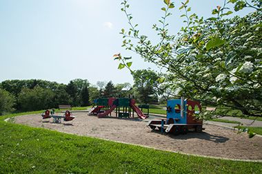
The east side of Hall Park features walking paths, picnic tables and a totlot playground. The park’s west side offers a basketball court, picnic tables and grills, a totlot playground and wading pool.
Rental & Permits
Outdoor Use and Event Space: Learn how to reserve park space for corporate events, community celebrations, and more.
History
Name: The park was named for Elizabeth Hall School adjacent to the park, which was built in 1960. Elizabeth Hall was a teacher who served as assistant superintendent for elementary education for Minneapolis schools 1911-1934. In 1979 the park board requested public input to rename the park. The city council passed a resolution to ask the board to name it for council member and former park commissioner Louis DeMars, but the neighborhood ultimately decided to keep the name of the school.
Acquisition and Development
The Hall neighborhood was identified in a 1938 study of the city’s playground needs as one of five neighborhoods that had an “acute” need for a playground, but was unable to pay the costs of acquiring land and developing a park through property assessments. Studies in 1944 and 1965 repeated the recommendation for a playground in the neighborhood.
The park board took a tiny step toward a Hall Park in 1968 when it built a totlot at Hall School. In 1970 the board applied for federal funds to acquire five new parks in the city, but only three of those projects were approved. Three parks on the near southside received federal funding, but the Hall project did not.
The creation of more than a totlot in the area had to wait until the Minneapolis housing authority began a program of urban renewal in the neighborhood. In 1977, six acres of land adjoining the school were acquired from the housing authority for a park. Plans for a playground park, including a shelter, were approved shortly after and construction of the park began. Most park improvements were completed in 1979, but construction of the shelter stretched into 1980. The total cost of the shelter was $83,598.
Following park improvements in 2003-2004, a capital project was completed in 2023 using equity-based funds from the 20-Year Neighborhood Park Plan. It included a new and expanded playground, paths, lighting, picnic tables, benches and a grill on the park’s west side, with native shrubs and pollinator-friendly areas of restored turf and a shade structure added to the wading pool. East side improvements focused around a new bike skills course with a bike-able sculpture designed and fabricated with youth from Juxtaposition Arts’ Environmental Design Lab. Other east side enhancements included lighting and benches, native plantings, stormwater infiltration, bike racks and a repair center. Sidewalk murals designed and painted by local artist and teacher Melodee Strong and Franklin Middle School students visually guide people through both sides of the park and its connecting bridge.
Park history through 2008 compiled and written by David C. Smith; updates to the present by MPRB staff.
Playground Equipment
Hall Park features a tot lot for the smallest family members.
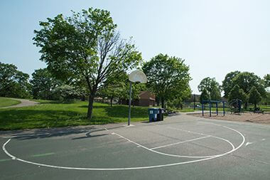
Basketball Court
Sign up for one of our many year-round youth and adults sports leagues.

West Side Walking Path
The park’s west side offers a basketball court, picnic tables and grills, a totlot playground and wading pool.
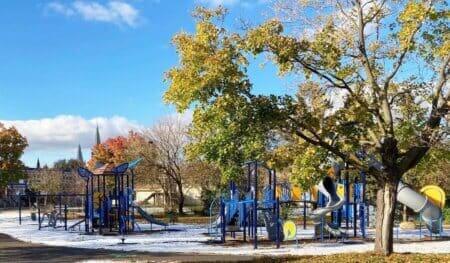
West Side Playground
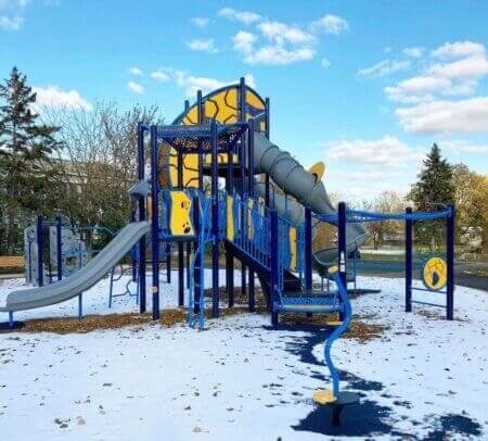
West Side Playground Expansion
West side playground was expanded and new equipment added in 2023
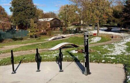
Bike Racks and Repair Center
Bike racks and repair center overlook a mountain bike skills course on the park's east side
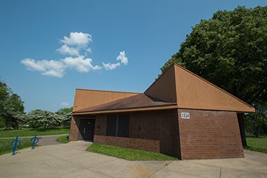
Restroom Facility
Take a break at Hall Park.
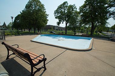
Wading Pool
Cool off in the summer at the Hall Park Wading Pool. See our other wading pool locations.
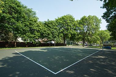
Volleyball Court
Sign up for one of our many year-round youth and adults sports leagues.
Park Board Announcements
There are no announcements at this time. Please check back soon.