


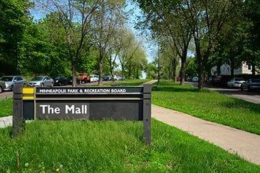
The Mall Park
Park Hours
6 am-midnight
Ordinance PB-2-33
Features & Amenities
- Walking Path
![]() Your NPP20 money at work: Maintenance is increasing at all neighborhood parks, thanks to additional annual funding from the 20-Year Neighborhood Park Plan (NPP20). This initiative also funds ongoing rehabilitation and major project to restore neighborhood parks and help address racial and economic equity. Find Out More
Your NPP20 money at work: Maintenance is increasing at all neighborhood parks, thanks to additional annual funding from the 20-Year Neighborhood Park Plan (NPP20). This initiative also funds ongoing rehabilitation and major project to restore neighborhood parks and help address racial and economic equity. Find Out More
Park Details
Starting at Lake Calhoun Parkway near the channel between Lake of the Isles and Lake Calhoun, The Mall travels East before reaching the Uptown Transit Station and Walker Community Library; from there, the parkway circles back to its starting point.
Rentals & Permits
History
Name: The five-block boulevard from Hennepin Avenue to the lakes was known as Twenty-ninth Street Boulevard at the time of its acquisition in May, 1912 until it was officially named The Mall on December 17, 1912. The name was selected after the unusual action by the park board of requesting public input in choosing a name. Park board records indicate that the Lake Calhoun Improvement Association submitted recommendations and shortly after, the name “The Mall” was chosen. The recommendations of the improvement association are not recorded, but it is likely, given the request for input, that the name chosen was among those preferred by the neighborhood group.
Acquisition and Development
Less than a month after the huge public celebration of the opening of the channel that linked Lake of the Isles and Lake Calhoun in July 1911, the park board received a petition requesting the park board to create a parkway from Hennepin Avenue to the new channel along the south side of the railroad tracks. That the issue was already being widely discussed, at least in the neighborhood, is demonstrated by the fact that the board received petitions at the same time from people who opposed the new parkway.
Those who wanted the parkway, a group organized under the name of The Lake District Protective Association, presented the park board with a check for $460 in September to pay for the cost of appraising the land and the expense of assessing the costs to property owners in the vicinity. With that as an inducement, the board proceeded to determine the cost of acquiring the land and building a parkway.
A couple contemporary developments in the neighborhood seemed to motivate residents to request that parkway. At the west end was the symbol-of-progress channel that connected the lakes. But perhaps as importantly, at the east end was the sparkling new classical Walker Library on Hennepin Avenue, which was also completed in 1911.
The true motivation for the Lake District Protective Association, however, may have been that the strip of land beside the railroad tracks was coveted by some who proposed industrial developments there. To many people, industrial use of that land would have been incompatible with the symbols of progress and refinement that stood at either end of it.
On October 16, 1911 the park board designated the land for acquisition and estimated that the total cost of acquisition and development would be $123,349, with slightly more than $80,000 to buy the land. The understanding from the beginning was that the total amount would be assessed on benefited districts—or property in the surrounding neighborhood.
The park board proceeded to prepare detailed lists of how much what it would pay property owners and how much it would assess surrounding property for the costs and presented them in March 1912. A final round of community meetings was held to determine willingness to pay for the improvements and on April 1, 1912 a citizens group called the Committee of Six, composed equally of proponents and opponents to the plans for the mall, agreed to defer to the decision of the park board in the matter. The park board took little time to confirm the damage awards and assessments, doing so on May 6, 1912.
The land taken for the parkway included seven houses, which were sold and removed from the land before road construction began.
The double roadway that was built is noteworthy in park history because it was used to test a new method of pavement: a two-course pavement of concrete and an asphalt-concrete mix. Park superintendent Theodore Wirth imported two paving experts, one from Winnipeg and one from Chicago, to assist with the construction. Wirth sought permission to pay the additional expenses of hiring the experts only after they had been paid and returned home, but the board retroactively approved those payments. Wirth deemed the pavement result such a success that the method was then used on other parkways.
Wirth changed his opinion on the surfacing material, however, within a few years. He determined that the asphalt concrete mix was too expensive and not durable enough. It was already apparent to Wirth within a few years that The Mall pavement would have to be repaired. This was at a time when more than half of the parkways in the city were still not paved at all.
In 1921, when the repaving was authorized, Wirth complained in his annual report that restrictions were needed on vehicles and loads on parkways because pavements could not withstand the heavy traffic to which they were being subjected.
In 1914 when the parkway was completed and landscaped, Wirth reported that it had become a favorite route of “automobilists” driving to and from Lake Calhoun and Lake Harriet.
The Mall was the site of another experiment in park engineering when in 1923 the Minneapolis General Electric Company installed test lighting consisting of 12-foot ornamental standards with 400 candle-power incandescent lights 100 feet apart along the parkway. Wirth noted in his memoirs that the cost of operation and maintenance of the lights on The Mall proved too costly for system-wide use.
In Wirth’s reminiscences of his first twenty-five years as park superintendent, published in the 1930 annual report, he included before and after photos of The Mall. He selected several other locations for before and after photos too, but his inclusion of The Mall photos attaches, from the distance of eighty years, an odd importance to a park property that did not play a very large role in the life of the city or in his own formidable portfolio of accomplishments.
The Mall largely disappeared from public and park board attention until in 1962 the City Council requested an easement along The Mall for street and parking purposes. The park board approved the easement until a howl of protest from the neighborhood forced them to rescind their action before the City Council had time to formally accept it.
The only significant development on The Mall since it was constructed was the closing of the intersection with Hennepin Avenue when the old Walker Library was replaced with a new underground library at Hennepin and Lagoon in 1981. The library board asked to purchase a piece of The Mall for the new library, but the park board refused. It cited its land policy, developed in the 1960s at a time when roads and freeways were encroaching on park property, which rejected the sale of any useful park land for any reason.
Roads being roads, however, the park board did spend over $400,000 to repave the road and replace the lighting on The Mall in 1989. Now instead of providing a buffer between railroad tracks and apartment buildings, The Mall serves as a pleasant stretch of green alongside the bike trail that now occupies the former tracks.
Park history compiled and written by David C. Smith.
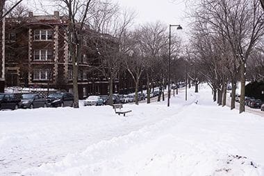
The Mall in Winter
From The Mall Parkway, hop on the Midtown Greenway to commute across the city.
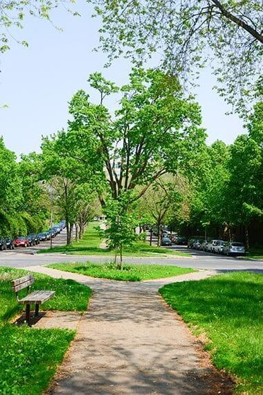
Walking Path
Enjoy a shady stroll along The Mall Park's paved walking trails.
The Mall Park
The normally tranquil Mall Park becomes lively for one weekend during the summer when the Uptown Art Fair is hosted there.
The Mall Greenspace
Enjoy a shady stroll along The Mall Park's paved walking trails.
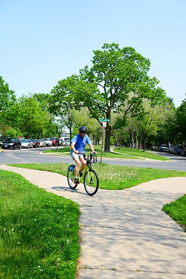
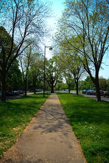
Bike Path
From The Mall Parkway, hop on the Midtown Greenway to commute across the city.
Park Board Announcements
There are no announcements at this time. Please check back soon.