


Reserve Block 40 Park
Park Hours
6 am-midnight
Ordinance PB-2-33
Features & Amenities
- Picnic Area
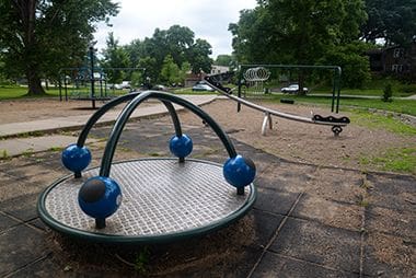
- Playground/Tot Lot
Not finding what you’re looking for?
Search Parks & Destinations
Park Projects
See what’s currently in the works for this park. Some projects may be under the name of the regional park or service area it lives within. View Current Projects
![]()
Your NPP20 money at work:
Maintenance is increasing at all neighborhood parks, thanks to additional annual funding from the 20-Year Neighborhood Park Plan (NPP20). This initiative also funds ongoing rehabilitation and major project to restore neighborhood parks and help address racial and economic equity.
Park Details
Rentals & Permits
Outdoor Use and Event Space: Learn how to reserve park space for corporate events, community celebrations, and more.
History
Name: The park has always been referred to by its designation on plat maps in a neighborhood known as McNair Park. The park has never been officially named.
Acquisition and Development
The triangular block of land west of Cedar Lake was part of the land designated for acquisition on April 6, 1908 that included parts of the west shore of Cedar Lake and expanded Glenwood (Wirth) Park to include Brownie Lake. The land was almost immediately forgotten as it did not feature in park board plans for the development of either Cedar Lake or Brownie Lake. In a 1909 map showing the proposed development of Cedar Lake Parkway, the land was not indicated as park property. In later park inventories, the acquisition date was incorrectly listed as 1909.
One the few suggestions for the development of the park is shown on a 1921 map prepared by park superintendent Theodore Wirth of possible developments in the vicinity of Cedar Lake. On that plan Wirth recommended two tennis courts for the park. Other than that reference, the park is not mentioned in park documents until 1953.
The park board’s 1953 annual report noted that the low land had been in the possession of the park board for many years. The park is mentioned in the 1953 report because in that year, with the development of the Basswood Addition to the south of the park, the area’s new residents had petitioned to have the block improved as a park.
In response to those petitions, filling and rough grading of the park were done in 1953 and curbs were installed on two sides of the park. The western edge of the park was actually in St. Louis Park, and St Louis Park had not yet brought the street there up to grade, so curbing that side of the park was delayed.
Fill for the park was obtained from the Prudential Building site to the west of Brownie Lake. The land for the Prudential Building, which had once been a part of Wirth Park, had been sold to Prudential in 1952. A condition of the sale of that land was that the park board would construct an access road to the property between Brownie Lake and Highway 12. The construction of that road provided the opportunity and the material to fill the low land of Reserve Block 40. The cost of improvements was assessed to property in the neighborhood. The first playground equipment for the small park was authorized by the board in 1957 and installed in 1958.
The playground equipment in the park was replaced in 2004.
Volunteers working with park board arborists planted 18 new trees in the park in 2011.
Park history compiled and written by David C. Smith.
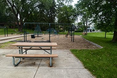
Reserve Block 40 Playground
Enjoy a leisurely day in the park as the kids enjoy themselves on the playground.
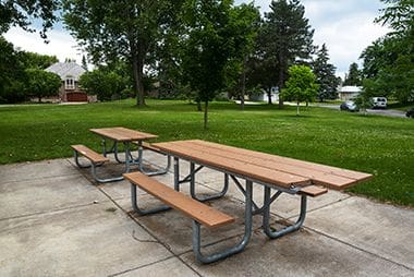
Picnic Area
While the Picnic Areas here are a first-come-first-serve basis, the Park Board has several reservable picnic sites to host your birthday parties and other celebrations.
Reserve Block 40 Park
Reserve Block 40 Park sits on the edge of Minneapolis, on the west side of Cedar Lake.
Playground
Enjoy a leisurely day in the park as the kids enjoy themselves on the playground.
Park Board Announcements
There are no announcements at this time. Please check back soon.