


Dell Park
Address
4401 Thomas Ave. S
Minneapolis, MN 55410
Plan Your Route
Contact
Phone: 612-230-6400
Email: info@minneapolisparks.org
Park Hours
6 am–midnight
Ordinance PB-2-33
Features & Amenities
- Open, tree-lined green space
Not finding what you’re looking for?
Search Parks & Destinations
Good to Know
Nearby Parks:
Nearby Trails and Parkways:
- Lake Harriet Parkway
- William Berry Parkway
![]()
Your NPP20 money at work:
Maintenance is increasing at all neighborhood parks, thanks to additional annual funding from the 20-Year Neighborhood Park Plan (NPP20). This initiative also funds ongoing rehabilitation and major project to restore neighborhood parks and help address racial and economic equity.
Park Details
Rentals & Permits
Outdoor Use and Event Space: Learn how to reserve park space for corporate events, community celebrations, and more.
History
Name: The park was named for its topography, a small dell approaching Lake Harriet.
Acquisition and Development
On June 17, 1907 the park board approved a petition from the Linden Hills Improvement Association that the park board accept and maintain the land as a park. A condition imposed by the park board was that the improvement association or interested property owners first “suitably curb and fill (the park) to grade with good soil.”
In 1909, park superintendent Theodore Wirth presented a plan to the park board that would have changed the little park dramatically. As the park board was proceeding with plans to connect the chain of lakes with navigable canals—the first canal between Lake of the Isles and Lake Calhoun opened in 1911—it requested from Wirth a plan to connect Lake Calhoun with Lake Harriet. Wirth suggested three alternatives. One was a canal south from Lake Calhoun along Washburn Avenue to 43rd Street, then east to Thomas Avenue and along Thomas to 45th Street where it would head east again to connect to Lake Harriet. The plan would have turned Dell Park into a waterway between the lakes. Although he presented the option, Wirth considered the route impractical and said he preferred a route through Lakewood Cemetery. A connection between Lake Calhoun and Lake Harriet was never pursued, in part because of the seven-foot drop in elevation between the lakes: any canal route would have required a lock and dam to be navigable making the cost prohibitive.
Park history compiled and written by David C. Smith.

Dell Park
Dell Park sits near many other amenities, such as Beard's Plaisance, Linden Hills Park, and Lake Harriet Parkway.
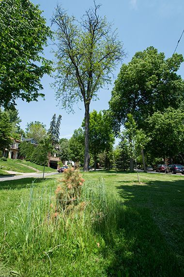
Dell Park Trees
Learn how to reserve park space for corporate events, community celebrations, and more.
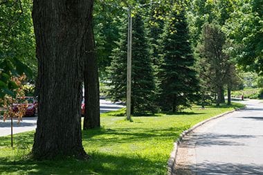
Pine Trees in Dell Park
The park was named for its topography, a small dell approaching Lake Harriet.
Park Board Announcements
There are no announcements at this time. Please check back soon.