


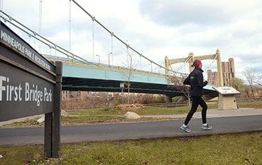
First Bridge Park
Address
1 West River Parkway
Minneapolis, MN 55401
Plan Your Route
Contact
Phone: 612-230-6400
Email: info@minneapolisparks.org
Park Hours
6 am-midnight in developed areas
6 am-10 pm in undeveloped areas
Ordinance PB-2-33
First Bridge Park
Part of: Central Mississippi Riverfront Regional Park
Find a Recreation Center
Features & Amenities
- Biking Path
- Public Art
- Walking Path
Not finding what you’re looking for?
Search Parks & Destinations
Long-Range Vision Plans
This park will be affected by a completed park or service area long-range vision plan. View Long-Range Vision Plans.

Park Details
A series of bridges of different structural types has existed at this location throughout the years. The first suspension bridge on the site was built in 1855.
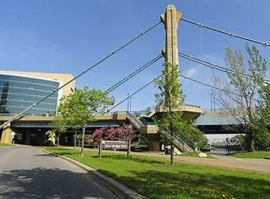
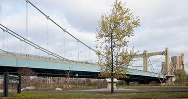
The park is located under and adjacent to the Hennepin Avenue Bridge between West River Parkway and the Mississippi River in the Central Riverfront Regional Park. Interpretive markers provide historical information and photographs about the site.
The park features a river-edge walkway with ornamental railings, lighting, other circulation features and landscaping. A continuous, curving seatwall along the back of the river-edge walkway offers many spots to sit and watch the river flowing by.
The wall and other features are enhanced by many artist-designed whimsical bronze sculptures of water creatures. A large piece of native limestone quarried near the site has been cut and erected as a monumental art piece.
Rental & Permits
Outdoor Use and Event Space: Learn how to reserve park space for corporate events, community celebrations, and more.
Parkway Use: You must obtain a permit for special use of the parkway including closures, and dumpsters, trucks, limousines or carriages on the parkway. View parkway permit details.
History
Name: The name for the park was chosen because it is the site of the first bridge across the Mississippi River—anywhere. The first suspension bridge on the site was built by Franklin Steele in 1855.
Acquisition and Development
The land for First Bridge Park was acquired in 1985 from the real estate subsidiary of Burlington Northern Railroad, which owned much of the land along the river downtown. The company donated 22 acres of riverfront to the city in part in return for changes in zoning that enabled the company to develop other land holdings in the area for commercial and residential purposes. A condition of the donation was that the park board construct a park and parkway along the river from Plymouth Avenue to Portland Avenue by 1987. That parkway was completed in 1987 and later named James I. Rice Parkway.
The impetus for the creation of First Bridge Park, which features the excavated footings of the three earliest bridges on the site, was the construction of a new Federal Reserve Bank on the site of the former railroad depot adjacent to James Rice Parkway. The park was completed in 2001.
Along with Mill Ruins Park, First Bridge Park represents an effort to preserve and illustrate the history of Minneapolis.
Park history compiled and written by David C. Smith.
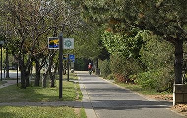
West River Parkway Trail
Walk, run, or bike along West River Parkway, part of the Grand Rounds Scenic Byway.
First Bridge Park
Along with Mill Ruins Park, First Bridge Park represents an effort to preserve and illustrate the history of Minneapolis.
First Bridge
The park is located under and adjacent to the Hennepin Avenue Bridge between West River Parkway and the Mississippi River in the Central Mississippi Riverfront Regional Park.
First Bridge alongside West River Parkway
Walk, run, or bike along West River Parkway, part of the Grand Rounds Scenic Byway.
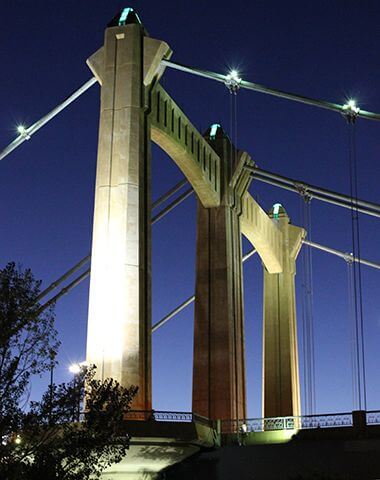
First Bridge at Night
The park is located under and adjacent to the Hennepin Avenue Bridge between West River Parkway and the Mississippi River in the Central Mississippi Riverfront Regional Park.
Park Board Announcements
There are no announcements at this time. Please check back soon.