


James I. Rice Parkway
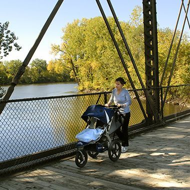
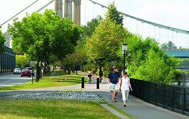
West River Parkway
Search for information, find activities, or browse board meetings and agendas.
East and West banks of the Mississippi River between Plymouth Avenue North & 35W bridges
Phone: 612-230-6400
Email: info@minneapolisparks.org
6 am-midnight in developed areas
6 am-10 pm in undeveloped areas
Ordinance PB-2-33
James I. Rice Parkway
West River Parkway
Not finding what you’re looking for?
Search Parks & Destinations
Nearby Attractions:
Nearby Trail: St. Anthony Falls Heritage Trail
Public Art:
Weddings at:
See what’s currently in the works for this park. Some projects may be under the name of the regional park or service area it lives within. View Current Projects
This park will be affected by a completed park or service area master plan. View Master Plans

Size: more than 71 acres
Neighborhood: Downtown East, Marcy Holmes, Nicollet Island-East Bank, North Loop, St. Anthony West
Service Area: North, Northeast
Commissioner District: 1, 4
Annual Patron Parking Permit: Enjoy parking privileges in specially designated spaces at some of our most popular regional parks. View parking permit details.
Indoor Weddings: Make your ceremony unique and memorable. View wedding permit details.
Outdoor Use and Event Space: Learn how to reserve park space for corporate events, community celebrations, and more.
Outdoor Weddings: Make your outdoor ceremony unique and memorable. View wedding permit details.
Parkway Use: You must obtain a permit for special use of the parkway including closures, and dumpsters, trucks, limousines or carriages on the parkway. View parkway permit details.
Picnics: Reserve a picnic site for your upcoming birthday party, reunion, company picnic, or other special event. View picnic permit details.
Private Charters: Private Charters on the Mississippi River available through Paradise Charter Cruises.
Name: The park site has always been referred to by the name of the man whose eponymous business operated on the site from the late 1800s. Benjamin Franklin Nelson built a thriving paper mill and roofing materials business on the site in the 1880s. Prior to that it had been the site of sawmills. Nelson was active in city affairs at the time. As a city alderman, he was an ex-officio park commissioner on the first park board in 1883. He was subsequently chosen by the park board to fill the term of Andrew Haugan, one of the original twelve appointed commissioners who had resigned from the board. Nelson was one of three commissioners who selected Logan Park as the site of the first park in what was then called the East Division of the city. Nelson also served for many years on the school board.
Acquisition and Development
The site was acquired in a purchase and trade with the Minnesota Department of Transportation in 1987.
The land had originally been included in the St. Anthony Historic District, but was excluded in 1973 when the land was acquired by the state for a planned I-335 freeway across northeast Minneapolis to connect I-35W to I-94 west of the river. The site would have held the east end of a bridge across the river for that freeway. The manufacturing buildings on the site were demolished at that time.
In 1987, however, as Boom Island Park to the north of the site and the West River Parkway across the river were being developed by the park board, the state contacted the park board with an offer to sell the B. F. Nelson land.
Plans for I-335 had been abandoned, so the state no longer needed the land. It had also learned that a proposed change in federal policy made it wise to sell the land quickly. When the land was acquired for a freeway, the federal government paid ninety percent of the $5 million cost, with the state paying the rest. Until 1987, the federal government had permitted states to sell land that was no longer needed for freeways without reimbursing the federal government for its share of the purchase price. But the state’s transportation department said it had learned that the federal government was about to change its policy and require reimbursement for its investment. Before that change would take effect, MnDOT said it would sell the park board the B. F. Nelson site for the state’s investment, which was only ten percent of the original cost.
But the state had other motives, too. It needed a bit more park land from The Parade for the construction of I-394 west from downtown. Moreover, it had not been successful in the remediation of some polluted industrial land it had promised to turn over to the park board as part of an agreement for taking a portion of North Mississippi Park for freeway I-94 in 1974.
The state ultimately sold the B. F. Nelson site to the park board for a little more than $200,000, plus land at The Parade land and the polluted land near North Mississippi Park.
A path, river overlook and fishing dock were built in 1996, in part with funds from the city’s Neighborhood Revitalization Program through the St. Anthony West Neighborhood Organization.
Environmental testing of the land as a “brownfield” took place in 2001. In part because of buried industrial waste from years as a manufacturing site, the master plan for the area is to leave it primarily as a greenspace connecting Boom Island Park and Nicollet Island.
In 2006, the park board received a grant of $775,000 from the Mississippi Watershed Management Organization for initial design and development of the site.
The St. Anthony West Neighborhood Organization raised funds to refurbish and relocate the Pioneer Statue to the park from its location at Pioneer Triangle across Marshall Avenue from the park. The statue was moved to its new home in 2010 at the beginning of development of the park. The area around the statue was landscaped and a parking lot was built nearby in 2011. In addition new trails were created through the park in conjunction with improvements to the adjacent Boom Island Park.
Name: The park gets its name from the island that it once was. The island was named for the booms that were used to separate logs floated down the Mississippi River to sawmills powered by St. Anthony Falls. Each log cut along the tributaries of the Mississippi River was “branded.” Each lumber company put is own stamp on the end of its logs and they were separated using those stamps and directed to the proper saw mill by men working from Boom Island. The sawmills at the falls were eventually replaced by flour mills.
Acquisition and Development
The land that had ceased to be an island decades earlier due to a build-up of silt and sawdust was purchased by the park board with funds from the state legislature through the Metropolitan Council in 1982. The land was purchased from a construction company for $2.6 million. The land had been targeted for acquisition in the 1978 plan for the development of the central riverfront as a park by the Riverfront Development Coordinating Board (RDCB), which was chaired by park commissioner Ole Olson. The RCDB considered plans to convert the land to an island once again, but decided against it due to the cost.
The first phase of the park was dedicated in 1987 shortly before the completion and dedication of James I. Rice Parkway across the river. The park was designed by Ted Wirth, grandson of former park superintendent Theodore Wirth. At the time Ted Wirth was a landscape architect based in Montana. The park was mostly completed in 1988.
The park featured a marina, boat dock, a landmark miniature lighthouse in the river, picnic shelters and a playground for small children. An old railroad bridge from Boom Island to Nicollet Island was converted into a bicycle and pedestrian bridge.
The acquisition and development of the park was seen at the time as an important spur to redevelopment of the Central Riverfront, along with Nicollet Island, Historic Main Street and Father Hennepin Bluffs on the east side of the river and James Rice Parkway and Mill Ruins Park on the west side.
In 1988 the paddle boat Anson Northrup began using the docks at Boom Island Park to board passengers for river cruises. That boat has since been replaced by the Mississippi Queen, which continues to offer cruise service from the park.
A complete redesign of the park began in 2011, with new landscaping and paths intended to establish a greater connection to the river. The plaza along the river and the marina were extensively rehabilitated.
Boom Island Park is contiguous with B. F. Nelson Park to the south and is part of Central Riverfront Regional Park.
Name: The park was named for Father Louis Hennepin, a Franciscan priest who was the first European to view St. Anthony Falls from the site of the park in 1680. Hennepin named the falls for his patron saint, St. Anthony of Padua. Hennepin was also the first European to make a record of viewing Niagara Falls.
A portion of the park is officially known as Phillip W. Pillsbury Park. The Pillsbury Company donated 2.4 acres of land to enlarge the park in 1981. The Pillsbury family, founders of the milling company, had been linked with Minneapolis parks from the earliest days of the park board. George Pillsbury was one of the Minneapolis businessmen who had been instrumental in pushing the Minneapolis Board of Trade to draft legislation for presentation to the state legislature to create the Minneapolis Board of Park Commissioners in 1883. His brother John Pillsbury, a former governor of Minnesota, was one of the first twelve park commissioners appointed by the legislation. It was John Pillsbury who proposed to the new park board that it hire landscape architect Horace Cleveland to create a plan for the fledgling park system. The result was Cleveland’s “Suggestions for a System of Parks and Parkways for the City of Minneapolis,” presented to the park board in June 1883.
John Pillsbury’s son, Alfred, also became a park commissioner and was president of the park board in the 1930s.
Acquisition and Development
The initial land for the park was acquired by the park board in 1977. It was the first park land to be acquired for what would become Central Riverfront Regional Park.
The land was acquired for about $800,000 with funds provided by the state legislature through the Metropolitan Council. The land had been part of the initial, and least controversial, part of the plan for the central riverfront created by the Riverfront Development Coordinating Board (RDCB), a joint effort of the park board, city council and the Minneapolis housing authority, chaired by park commissioner Ole Olson. The RDCB envisioned the bluff left in its natural state with trails down to and along the river. The RDCB’s plan also included Hennepin Island and the east channel of the river, but those parts of the plan have never been completely implemented. The plan for the area was intended to evoke images of Huck Finn. The bluff park was initially developed and opened in 1979. It was designed by famous landscape architect Hideo Sasaki.
In 1981 the park was augmented by a donation of 2.4 aces of land from the Pillsbury Company in honor of Phillip W. Pillsbury.
Another half-acre of land on the bluff, Lucy Wilder Morris Park, was officially added to the park when title to the land was turned over to the park board by the Hennepin County Historical Society in 1989. The park board had been maintaining Lucy Wilder Morris Park, however, since 1931 under an agreement with and funding from the Daughters of American Colonists.
The finishing touch to the park, which gave it its present appeal, was the agreement to convert the Stone Arch Bridge to a pedestrian and bicycle path in 1993. The bridge connects the eastern edge of the park with the west bank of the river and Mill Ruins Park.
Proposals to convert the east channel of the river between Father Hennepin Bluff Park and Hennepin Island into a whitewater park have been under consideration for years. The sticking point has always been the source of funding for that development.
In 2011 the stairs from Main Street down to Hennepin Island and the river were repaired.
Name: The name for the park was chosen because it is the site of the first bridge across the Mississippi River—anywhere. The first suspension bridge on the site was built by Franklin Steele in 1855.
Acquisition and Development
The land for First Bridge Park was acquired in 1985 from the real estate subsidiary of Burlington Northern Railroad, which owned much of the land along the river downtown. The company donated 22 acres of riverfront to the city in part in return for changes in zoning that enabled the company to develop other land holdings in the area for commercial and residential purposes. A condition of the donation was that the park board construct a park and parkway along the river from Plymouth Avenue to Portland Avenue by 1987. That parkway was completed in 1987 and later named James I. Rice Parkway.
The impetus for the creation of First Bridge Park, which features the excavated footings of the three earliest bridges on the site, was the construction of a new Federal Reserve Bank on the site of the former railroad depot adjacent to James Rice Parkway. The park was completed in 2001.
Along with Mill Ruins Park, First Bridge Park represents an effort to preserve and illustrate the history of Minneapolis.
Name: The park was named for the ruins of the flour mills which occupy the site.
Acquisition and Development
The land for the park was acquired in 1985 as a part of the acquisition of the west river banks for West River Parkway. A company that manufactured concrete held a long-term lease on the land, which it acquired after the nearby lock was built in 1962 to lift boats to the upper harbor above St. Anthony Falls. After the U.S. Army Corps of Engineers filled the old tail races from the mills to construct the lock, it leased the land for 99 years to the company that used it as a storage site for sand and gravel. The park board purchased the lease and relocated the company’s storage facilities upriver at a cost of $8 million. The funds were provided primarily by the state legislature though the Metropolitan Council as part of efforts begun in the 1970s to redevelop the riverfront and create a central riverfront park.
From early on in the efforts to redevelop the area and extend West River Parkway into downtown, the historical significance of the site was an important consideration. The site was excavated and its development planned under the direction of the St. Anthony Falls Heritage Board, created by the legislature in 1988, and the park board. The National Park Service contributed to the development of the park as part of the Mississippi National River and Recreation Area, which had been established by the U. S. Congress in 1988.
The goal of the development of Mill Ruins Park was to give park visitors a glimpse into the history of the mills in the area, which had been so important to the history of the city and the region. The park was opened to the public in 2001.
In 2003 a 650-foot section of West River Parkway was converted to an oak plank road similar to the original plank road that spanned the canals which carried water back to the river after powering the mills. The park was completed in 2005.
The planks in the parkway were replaced by concrete in 2010 due to deterioration of the planks and their noisy condition.
Name: The island was named for Joseph Nicollet, a French explorer and cartographer who mapped the region of the Upper Mississippi River in the 1830s. In the Minnesota vernacular, Nicollet rhymes with “chiclet.” The name for the island existed before Minneapolis was created.
Acquisition and Development
Nicollet Island nearly became the first park land purchased in Minneapolis. In 1866 the Minnesota legislature approved the union of the two towns on either side of St. Anthony Falls, Minneapolis and St. Anthony. The act provided for the establishment of municipal buildings on the southern half of Nicollet Island and reserved the northern half of the island as a public park. The legislature mandated that voters of both towns had to approve the union for it to become official. Minneapolis voted first—and St. Anthony voters never got a chance to express their wishes, because Minneapolis voters defeated the measure by fewer than one hundred votes.
The vote was long remembered not for the potential union of the towns, which was accomplished anyway in 1872, but for the voters’ rejection of Nicollet Island as a park. The sticking point at the time was the cost of acquiring the island for the city, which was put at $30,000-$40,000. The issue became a rallying cry for park proponents over the next 17 years until the Minneapolis park board was created by the legislature—and approved by Minneapolis voters—in 1883.
Curiously, after the park board was created, it seemed to have no interest in creating a park on the island. One of the only references to the island in park board proceedings in the first couple decades of the park board’s existence was a request in 1894 from “the committee for the protection and improvement of Nicollet Island” for the park board to acquire the shores of the island. The request was referred by the park board to the city council. Whether the request may have generated some interest on the park board is not known, but the park board was in serious financial trouble at the time following the Panic of 1893 and it had no money for acquisitions.
In 1908, the park board did approve taking charge of a strip of land on the west side of the island, which was then owned by the city of Minneapolis and to spend up to $200 to improve the land. Later that year the park board established a committee to ask Mrs. W. W. Eastman to donate a strip of land around the island for a park. No follow-up reports are recorded for either of those actions.
As part of its ambitious plan for the redevelopment of nearly the entire downtown area, the Minneapolis Civic Commission in 1910 proposed turning Nicollet Island into a park, but once again no action was taken.
In 1915 park superintendent Theodore Wirth proposed the creation of a pier or park on the west side of Nicollet Island primarily to relieve overcrowding at the new Gateway park near the west end of Hennepin Bridge.
Wirth followed that recommendation three years later in his annual report with a suggestion that the park board acquire all the river banks, including those on Nicollet Island and Boom Island, from downtown to the northern city limits. He speculated at the time that Nicollet Island would “surely be acquired by the city,” and suggested that in the meantime the park board should lease or purchase the river banks on the island. Once again no action ensued and the issue of Nicollet Island largely disappeared from park board records for decades.
The idea of developing Nicollet Island as a park was introduced again in a 1960 park board report on its goals in anticipation of its hundredth birthday in 1983. In that report the park board estimated an expenditure of one million dollars to acquire land on Nicollet Island and near St. Anthony Falls for a park and historic site.
The issue re-emerged briefly in the park board’s 1964 annual report when it was noted that the park board had met with a citizens committee on Nicollet Island to hear proposals for the development of a 48-acre historic site on the island. The report noted that the park board had resolved to work with other city agencies to find a solution to the use of Nicollet Island and that it “seemed practical” to embellish the island with replicas of historic structures.
The ground work for preservation of the area was laid in 1971 when the land around the falls was placed on the National Park Service’s list of National Historic Districts. The impetus to develop the central riverfront, including Nicollet Island, came from a 1972 report entitled Mississippi/Minneapolis produced by city manager Tommy Thompson. In the wake of that report, which proposed redevelopment of the former industrial and railroad land of the riverfront, the park board, city council and the city housing authority created a Riverfront Development Coordinating Board (RDCB) in 1976 chaired by park commissioner Ole Olson. The RCDB’s primary objective was to create a development plan that could be submitted to the Metropolitan Council for funding through the state legislature. The RCDB produced a final report in 1978 that included specific recommendations for the development of a central riverfront park.
By that time the first park on Nicollet Island had already been created, by the city, as a part of the country’s 200th birthday party. The city had designated land on the southern tip of the island, acquired in 1944 and reserved for use as a public harbor, as Bicentennial Park. Two years later, the city turned over the park to the park board and the park board owned its first three acres of land on the central riverfront.
That acquisition was consistent with RCDB plans, almost all of which have now been executed, from a parkway on the west side of the river to the development of the east river bank as a park from Boom Island downstream to Father Hennepin Bluffs.
The plan for the lower half of the island called for converting the Island Sash and Door Company building into a quality restaurant, transforming the Durkee-Atwood building into a regional arts center and keeping the amphitheater that had been created in Bicentennial Park. For the upper half of the island the RCDB recommended creating a historic village, with preserved houses, a community meeting house, and a plaza with an information center. One of the only elements of the RCDB plan that has not been followed was for the development of the upper half of Nicollet Island.
In 1979 the park board purchased more than eleven acres of private property on the island and in 1981 added more than five acres from the housing authority and acquired the Durkee-Atwood building and it’s 3.6 acres of land. At that time the Durkee-Atwood acquisition was the most expensive in park board history at $6.1 million. The expense was due in part to the fact that the property was an active commercial property and the company had to be relocated. The park board later converted the building into the Nicollet Island Pavilion. The land was purchased with money provided by the Minnesota legislature through the Metropolitan Council. In 1986 the park board completed the long-negotiated purchase of the Island Sash and Door Building, which had already been converted into the Nicollet Island Inn and continues to operate under a lease from the park board.
The upper half of the island proved to be a more difficult deal due to conflicting views of how the land should be used. In 1983 the park board acquired title to four-plus acres of land from the Minneapolis Community Development Agency and leased the land back to MCDA. The MCDA then sold by lottery—for $1—99-year leases to individuals to maintain historic homes under very tight restrictions. The RCDB’s original plan allowed for De La Salle High School to continue operating on roughly six acres of the island and for residential use of about six acres on Grove Street, which were developed into townhomes in 1983.
The old railroad bridge on the north end of the island that connected to Boom Island was converted into a pedestrian bridge and another bridge was added to the island. Hennepin County relocated a section of the Broadway Avenue Bridge, which was being replaced, to connect Merriam Street on the island to Historic Main Street on the east bank.
In 2008 the park board approved the construction of a football field on park land adjacent to De La Salle High School. The field was built by the high school to serve the school and northeast Minneapolis.
Name: The name is descriptive of the structure and has been used since the bridge was built in 1883.
Acquisition and Development
The bridge is owned by the Minnesota Department of Transportation, but the deck of the bridge is maintained by the park board.
The bridge was built in 1883 by James J. Hill’s Great Northern Railroad. It carried two tracks into downtown Minneapolis and at its peak brought 80 passenger trains a day into Union Station.
The bridge was completed only five months after Minneapolis voters approved an act by the Minnesota legislature to create the Minneapolis Board of Park Commissioners, the original name of what today is the Minneapolis Park and Recreation Board. The bridge, however, played an important role in the creation of the park board.
The Minneapolis Board of Trade, an organization that functioned like a chamber of commerce for the city, was convened in January 1883 after a couple years of inactivity specifically to coordinate an effort to convince Hill’s railroad to participate in a Union Station in downtown Minneapolis. The bridge was under construction at the time. Shortly after the Board of Trade was reconvened, however, its members turned their attention to creating a park board for the city. The Board of Trade drafted the legislation to create a park board and, under the leadership of William King, convinced the legislature to pass the bill. Opponents of the measure attached a provision to the legislation that required approval by Minneapolis voters before it could take effect. King also headed the campaign to get voters to vote “Yes” on the Park Act, which they did in April 1883.
A member of the executive committee of the Board of Trade was Loren Fletcher, who was also, conveniently, speaker of the Minnesota House of Representatives that passed the park legislation. Fletcher was also the business partner of Charles Loring, a leading proponent of parks in Minneapolis, who became the first president of the park board and became known in the early years of the park board as the “Father of Minneapolis Parks.”
With the demise of the railroads as passenger carriers in the 1970s, Burlington Northern no longer needed a bridge into the city. In 1980 the railroad offered to sell the bridge to the city for $1, but concerns over the cost of maintenance of the structure caused the city to reject the offer.
In 1989, however, the railroad found a taker for the bridge: Hennepin County. County commissioners saw the potential value of the bridge for a future light-rail transit system. The county bought the bridge for $1,001.
The ownership of the bridge transferred to the state in 1993. Minneapolis legislators James Rice and John Sarna insisted that the state take control of the bridge when the state assumed control of light-rail development in the city. Rice and Sarna were influential proponents of park developments along the central riverfront. With the help of a $2 million federal grant for the reuse of historic transportation structures, the state and the park board worked out an agreement to convert the bridge to a pedestrian and bicycle path which would link Father Hennepin Bluff Park on the east bank of the river with West River Parkway. Informational displays on the history of the bridge, the river and St Anthony Falls were developed by the St Anthony Falls Heritage Board.
Park history compiled and written by David C. Smith.
Located off Historic Main Street, Nicollet Island Park has a promenade overlooking the first dam on the Mississippi, built in 1858, and features the elegant Nicollet Island Pavilion.
With stunning views of the Minneapolis skyline, Boom Island Park offers a picturesque site for weddings and picnics.
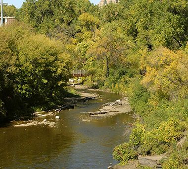
Stop off the trails to take a breather at this serene overlook where Bassett's Creek and the Mississippi River meet.
Walk right up to the railing to catch a view of Nicollet Island and the Hennepin Avenue Bridge.
As the centerpiece of Minneapolis' historic West Side Milling District, Mill Ruins Park combines an exploration of the history of Minneapolis with present day activities for all ages.
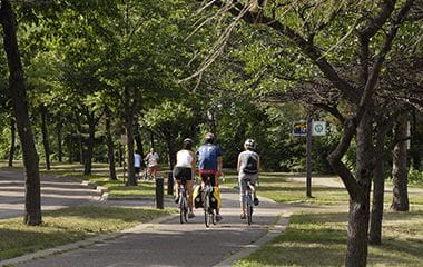
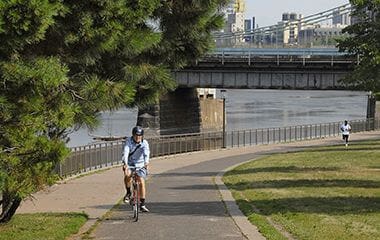
Enjoy 1.98 miles of pedestrian and bike trails along the West bank of the Mississippi River throughout this Regional Park.
Father Hennepin Bluff Park offers direct access to footpaths and bridges that display a unique view of the Mississippi Gorge, the Downtown skyline, and the Stone Arch Bridge.
There are no announcements at this time. Please check back soon.